
On the beach at Taku Village (T'aaku X'aka.aan)
Snettisham
2014 - 1: Accidental Opening
May 3-4
On the beach at Taku Village (T'aaku X'aka.aan)
 Any thoughts of opening Snettisham over the weekend
were
quelled by a persistent northerly that was destined to kick up 4-5’
seas in
Taku Inlet. But other the wind, the weather would be glorious, sunny
with
temperatures inching into the low 60s, and it begged for a spring
adventure. We
decided to camp at a beach close enough to Douglas Harbor that we
didn’t have
to get too far from shore or brave the seas. In the middle of an
intense
research project into the history of the Taku and Snettisham areas, the
old
Taku Village site came to mind, located somewhere on the beaches
between Pt.
Salisbury and Pt. Bishop—beaches that, independent of their history,
had caught
my eye many times on the way up the Taku as potentially good camping
and picnic
areas.
Any thoughts of opening Snettisham over the weekend
were
quelled by a persistent northerly that was destined to kick up 4-5’
seas in
Taku Inlet. But other the wind, the weather would be glorious, sunny
with
temperatures inching into the low 60s, and it begged for a spring
adventure. We
decided to camp at a beach close enough to Douglas Harbor that we
didn’t have
to get too far from shore or brave the seas. In the middle of an
intense
research project into the history of the Taku and Snettisham areas, the
old
Taku Village site came to mind, located somewhere on the beaches
between Pt.
Salisbury and Pt. Bishop—beaches that, independent of their history,
had caught
my eye many times on the way up the Taku as potentially good camping
and picnic
areas.
A brisk wind whipped around town Saturday morning
and weather.gov
was calling for 3-5’ seas at the end of Gastineau Channel, so I drove
out to
the rock dump on the way to the grocery store to see if the channel
were really
that bad. I saw nothing alarming, so we ate lunch, packed up, and
headed out
around 3:20. Much to my surprise, the channel was practically calm,
most of the
breeze following us out rather than crossing the channel as in a Taku
wind.
Close to Salisbury we had the eerie experience of feeling no wind in
our faces
when we stood up at speed; apparently our forward progress matched the
speed of
the wind at our stern, so standing up was like being in a bubble
(rather than
having the wind whip our faces). A single humpback whale sounded in the
distance.
Turning the corner, Taku Inlet showed a more
benign face
than expected, hardly showing more than a ripple. We looked at the
forecast,
which suggested improving seas the next day, and spontaneously decided
to head
to Snettisham instead of camping. Swayed by the idea of spring
migrants, possible
smelt, and hungry hummingbirds, I was drawn south under the sunny
skies. The
seas were pleasant most of the way down, building a little as we
approached
Snettisham, and then we got a little beaten up through the port and
over to the
homestead. The wind was blowing briskly down the river, a fairly rare
event
during the summer. There was a healthy smattering of loons and
murrlets, many
Bonaparte’s gulls, and a horned grebe that dove in front of the boat.
Leaving
all our camping gear on board (which was most of our cargo), Chris
carried
almost everything up in one load and, after opening the lodge and
satisfying
myself that it was intact, I anchored the boat farther downriver than
unusual,
as I expected a low tide departure.
Back on land, Cailey raced in happy circles on the
meadow
and Chris reported that all cabins were standing, but that I should
look at the
bridge. Though it was intact, two large branches were laying across it
and more
were caught in the branches just above. We opened up Hermit Thrush,
then I
started getting the lodge ready while Chris cleared the bridge. I was
surprised
to find a note taped to the stovepipe in the cabin—had someone stopped
by and
written a note!? Of course not! It was from myself, reminding me to
move the stove
back a few inches from the wall where I’d nudged it so the hole would
support
the horizontal stack. It was obviously a good reminder! I lit the
pilots on the
stove, which worked flawlessly, Chris helped me secure the stove pipe,
I made
up some hummingbird food, and we had wine and cookies on the porch.
Bird
activity wasn’t as manic as it sometimes is in spring (maybe I’m too
late, or
possibly too early), but there was still a lot going on. American
pipits,
northwestern crows, and American robins fed in the intertidal zone; a
Lincoln’s
sparrow bopped around the benches below us; hummingbirds sipped
charmingly at
the pink salmonberry blossoms; and golden-crowned kinglets, sooty
grouse,
Pacific wrens, and varied thrushes sang all around. Later I would hear
the
first hermit thrush of the year as the light faded, and again the next
morning
at dawn.
Since the weather was so lovely and we’d intended
to camp
anyway, we decided to brave the large and hungry mosquitoes and have a
campfire. Chris got the fire going while I cooked macaroni and cheese
and took
a couple GPS readings of the SW corner of the property. We ate and
drank wine
around the fire until dusk, then carried blankets to Hermit Thrush, lit
the
little buddy propane heater for a few minutes to warm it up, and turned
in for
the night.
Despite about an hour in the middle of the night
fighting
mosquitoes (until Chris finally asked if the window might be open
because of
the propane heater, which it was), I slept very well. Cailey came up on
the bed
in the morning during the mosquito fiasco and helped keep us warm. I
got up
around eight, fed Cailey, and headed up to the olive barrel with dish
gloves,
Torsten’s GPS, camera, and hoe. When nearly there, I backtracked to
close the
valves on the cabin lines, but found them already shut.

 Up at the top of the system, the creek and olive
barrel
looked much as I’d left them. I set to work pulling the larger rocks
out of the
barrel’s hollow from the previous year and using them to block and
divert the
main current away so I could clear it out better. The hoe was doing a
great job
of scraping out the smaller stones, but I soon remembered that I needed
to
replace the screens over the mouth of the barrel before placing it in
the
stream. I left the project until the next trip, took a GPS waypoint,
and headed
back down to Hermit Thrush rather than back to the lodge. I took its
GPS location,
then the location of the corner marker on the creek, then Harbor Seal,
then I
tried to get one on the rocky point. But the battery died, so I headed
back to
the lodge, stopping on the way to see if it had recharged enough for
another
reading. I managed to get a location on the other two cabins, so I
returned to
the point and took one there and then one at the lodge and one around
where the
NW corner is (which doesn’t have a marker or a tree, but only bearing
trees; I
simply guessed at the intersection of the two adjacent lines).
Up at the top of the system, the creek and olive
barrel
looked much as I’d left them. I set to work pulling the larger rocks
out of the
barrel’s hollow from the previous year and using them to block and
divert the
main current away so I could clear it out better. The hoe was doing a
great job
of scraping out the smaller stones, but I soon remembered that I needed
to
replace the screens over the mouth of the barrel before placing it in
the
stream. I left the project until the next trip, took a GPS waypoint,
and headed
back down to Hermit Thrush rather than back to the lodge. I took its
GPS location,
then the location of the corner marker on the creek, then Harbor Seal,
then I
tried to get one on the rocky point. But the battery died, so I headed
back to
the lodge, stopping on the way to see if it had recharged enough for
another
reading. I managed to get a location on the other two cabins, so I
returned to
the point and took one there and then one at the lodge and one around
where the
NW corner is (which doesn’t have a marker or a tree, but only bearing
trees; I
simply guessed at the intersection of the two adjacent lines).
By that time, water was hot and Chris and I were ready for tea and
donuts on
the front porch. There were ducks on the water, but the bright sun
rendered
them little more than silhouettes with white heads, so I’m not sure
what they
were. I did hear Townsend’s warblers, though, and the hummingbirds were
beginning to come to the feeder (which they had not the night before).
We
watched the mud shore creep toward the boat as the tide lowered and
decided to
head out. I put the cooler on the kayak and headed to the water while
Chris
papered the windows and closed up. The kayak ride was short and the
water very
shallow, and though the boat was obviously floating I was worried about
grounding it while trying to pick up the anchor. Thankfully, we were in
a deep
channel and the boat never went aground as I pulled us back upriver.
Rather
than relying on the current taking us to deep water (the tide would
fall for
another hour and I didn’t want to get stuck), I started the motor as
soon as I
could and carried us past the shoals and then shut down. I fueled up,
got the
boat organized, and met Chris at the edge of deep water, leaving the
kayak up
at the edge of high tide behind a log and tied securely to a tree. I
took the
paddle, unable to think of a place where it would be safe from curious
bears.
 There was still a breeze coming down the river
(despite the
SE wind that was supposed to blow in that morning), so the ride out of
the port
was very comfortable with a following sea most of the way. A prodigious
number
of lions were on the rocks at the haulout. Not surprisingly, we were
against
the seas in Stephen’s Passage, but they were smooth rollers and, though
they
slowed us down, were not terribly uncomfortable. The chop got much
worse around
Grave Point where we started to hug the coast rather than crossing to
Grand
Island. Since we’d left early and hadn’t camped at historical locations
as
intended, we decided to do some exploring on the way home. The first
stop was
Point Greely on the south side of Taku Inlet where I’d read there’d
been a
village of several clan houses and perhaps 100 smaller houses. There
were at
least 40 lions at Circle Point as we passed, including one long
individual on a
nicely slanted crevasse apart from the others who looked all the world
like a
log. The going was slow, smacking against the steady, low chop, and we
inched
our way across Slocum Inlet to the first likely looking beach. It was
actually
a spectacular beach of oval rocks, sloping steeply up to the forest.
There was
a large rusty barrel or pipe structure up there, but we decided it was
likely
flotsam. The most intriguing find was raspberries growing at the edge
of the
beach—not native, but easily naturalized in Juneau gardens—and black
currents
farther in, a prized wild berry. The woods showed no sign of
civilization, but
Chris found some large bones which could hardly have been from anything
smaller
than a bear, and I found what appeared to be a pile of bear scat filled
with
reddish berries on which one or more wolves had pooped dark scat full
of deer
hair. The beach had quite a few interesting, spiky crab shells and
Chris found
the jaw of slender fish with tiny teeth which I have yet to identify.
There was still a breeze coming down the river
(despite the
SE wind that was supposed to blow in that morning), so the ride out of
the port
was very comfortable with a following sea most of the way. A prodigious
number
of lions were on the rocks at the haulout. Not surprisingly, we were
against
the seas in Stephen’s Passage, but they were smooth rollers and, though
they
slowed us down, were not terribly uncomfortable. The chop got much
worse around
Grave Point where we started to hug the coast rather than crossing to
Grand
Island. Since we’d left early and hadn’t camped at historical locations
as
intended, we decided to do some exploring on the way home. The first
stop was
Point Greely on the south side of Taku Inlet where I’d read there’d
been a
village of several clan houses and perhaps 100 smaller houses. There
were at
least 40 lions at Circle Point as we passed, including one long
individual on a
nicely slanted crevasse apart from the others who looked all the world
like a
log. The going was slow, smacking against the steady, low chop, and we
inched
our way across Slocum Inlet to the first likely looking beach. It was
actually
a spectacular beach of oval rocks, sloping steeply up to the forest.
There was
a large rusty barrel or pipe structure up there, but we decided it was
likely
flotsam. The most intriguing find was raspberries growing at the edge
of the
beach—not native, but easily naturalized in Juneau gardens—and black
currents
farther in, a prized wild berry. The woods showed no sign of
civilization, but
Chris found some large bones which could hardly have been from anything
smaller
than a bear, and I found what appeared to be a pile of bear scat filled
with
reddish berries on which one or more wolves had pooped dark scat full
of deer
hair. The beach had quite a few interesting, spiky crab shells and
Chris found
the jaw of slender fish with tiny teeth which I have yet to identify.
 With a choppy ride ahead we decided to forgo further
Greely
explorations in favor of getting across the inlet and checking out the
other
side. The ride was less bumpy but more splashy than before as we were
in the
trough or quartering the seas, but we made it across in good time and
soon
found what my dad describes as Mary Joyce’s cabin, where she’d stay if
the
inlet was too rough to make it to the lodge. It was situated just above
high
tide line and at the bottom of a steep slope up; the roof was gone and
the log
walls collapsing, but the stone fireplace was intact and I enjoyed the
decorative rock work, wondering if someone had personally selected the
small
round rocks concreted in a neat line across the face. I climbed the
slope and
found the trail to Pt. Bishop. There was lots of porcupine sign, both
in hidey
holes (one of which was at least five feet deep under a large root mass
on the
slope beside the cabin) and in the fresh feeding marks on the trunk of
a tree.
With a choppy ride ahead we decided to forgo further
Greely
explorations in favor of getting across the inlet and checking out the
other
side. The ride was less bumpy but more splashy than before as we were
in the
trough or quartering the seas, but we made it across in good time and
soon
found what my dad describes as Mary Joyce’s cabin, where she’d stay if
the
inlet was too rough to make it to the lodge. It was situated just above
high
tide line and at the bottom of a steep slope up; the roof was gone and
the log
walls collapsing, but the stone fireplace was intact and I enjoyed the
decorative rock work, wondering if someone had personally selected the
small
round rocks concreted in a neat line across the face. I climbed the
slope and
found the trail to Pt. Bishop. There was lots of porcupine sign, both
in hidey
holes (one of which was at least five feet deep under a large root mass
on the
slope beside the cabin) and in the fresh feeding marks on the trunk of
a tree.
From there cruised the shoreline toward Point
Salisbury
looking for the location of the Taku Village, T'aaku X'aka.aan. There
were three
possibilities—the bite closer to Bishop and two long adjacent beaches
closer to
Salisbury. Once we were there, the location was obvious; the Bishop
beach was
too small and did not have the right backdrop (I had a photo) and the
northern
of the two Salisbury beaches was too rocky behind the beach. We went
ashore at
the far end of that beach and had a picnic lunch of smoked salmon,
sausage,
smoked cheddar, and sun chips, gazing
out at the stunning view of Stephen’s Passage in the spring sunshine
and
enjoying the relative calm in the lee of Point Bishop.
 After lunch I entered the woods and headed south
looking for
clues. I passed a stone block with two supports sticking out of it that
may
have held a headstone at one time, but I knew I was at the village site
when
the forest on the slope behind the beach bore only skinny second growth
trees.
The photo I’d seen showed this slope cleared of timber. I found an old
cabin,
slumped toward the water, just inside the alders in a level patch
between rocky
outcrops, a lovely place for a home. I was initially uncertain about
its vintage,
in part because there was some artistic graffiti on the inside and
because
there were no other ruins around it except for the top of something
which might
have been a tub. I moved on, splitting my time between the lowlands
just above
the high tide line and the Point Bishop trail on the rise above,
searching for
clues. I got excited when I saw another cabin, but it turned out to be
an
Alascom building with no trespassing signs around it. In several places
big
patches of spruce bark were scraped clean by porcupines, some of them
glistening with fresh sap.
After lunch I entered the woods and headed south
looking for
clues. I passed a stone block with two supports sticking out of it that
may
have held a headstone at one time, but I knew I was at the village site
when
the forest on the slope behind the beach bore only skinny second growth
trees.
The photo I’d seen showed this slope cleared of timber. I found an old
cabin,
slumped toward the water, just inside the alders in a level patch
between rocky
outcrops, a lovely place for a home. I was initially uncertain about
its vintage,
in part because there was some artistic graffiti on the inside and
because
there were no other ruins around it except for the top of something
which might
have been a tub. I moved on, splitting my time between the lowlands
just above
the high tide line and the Point Bishop trail on the rise above,
searching for
clues. I got excited when I saw another cabin, but it turned out to be
an
Alascom building with no trespassing signs around it. In several places
big
patches of spruce bark were scraped clean by porcupines, some of them
glistening with fresh sap.
 Further on, and right on the trail, I passed a
cluster of
grave stones. Most had fallen or perhaps were always horizontal and I
could
discern writing on only three of them. One said “Mary Mother of Ben
and….” And
then the moss took over. Another included a Tlingit name and a very
faint
carving of what I think was a bear. The last was Gambier Bay Jim’s
headstone,
upright and fully legible. It showed his death as 1926, long after the
village
was abandoned. Perhaps his family brought him back there to be buried,
and
still maintain the headstone. One large obelisk had fallen and lay in a
stream.
I passed by as respectfully as I could, careful not to touch anything.
A little
further on I came across a lovely nook between two jutting rock
promontories on
the beach level which sported two structures, a cabin on the north side
and an
outhouse a few paces away on the south side. The mountain sloped in an
arc
behind them both. What a cozy place for a home! The roof on the cabin
was
mostly collapsed, but the walls were still standing, the wooden shelves
built
into them prompting a pang of longing in me for simple cabin living. A
shed-like structure was built onto the side of it and now harbored a
prodigious
pile of porcupine poop in the corner. The outhouse and its hole were
similarly
filled with poop and even a clump of porcupine hair.
Further on, and right on the trail, I passed a
cluster of
grave stones. Most had fallen or perhaps were always horizontal and I
could
discern writing on only three of them. One said “Mary Mother of Ben
and….” And
then the moss took over. Another included a Tlingit name and a very
faint
carving of what I think was a bear. The last was Gambier Bay Jim’s
headstone,
upright and fully legible. It showed his death as 1926, long after the
village
was abandoned. Perhaps his family brought him back there to be buried,
and
still maintain the headstone. One large obelisk had fallen and lay in a
stream.
I passed by as respectfully as I could, careful not to touch anything.
A little
further on I came across a lovely nook between two jutting rock
promontories on
the beach level which sported two structures, a cabin on the north side
and an
outhouse a few paces away on the south side. The mountain sloped in an
arc
behind them both. What a cozy place for a home! The roof on the cabin
was
mostly collapsed, but the walls were still standing, the wooden shelves
built
into them prompting a pang of longing in me for simple cabin living. A
shed-like structure was built onto the side of it and now harbored a
prodigious
pile of porcupine poop in the corner. The outhouse and its hole were
similarly
filled with poop and even a clump of porcupine hair.
That cabin was just at the end of the smooth beach
before it
became rocky again as it approached Salisbury. I turned around and
meandered
back along the beach and the forest, picking up as much trash from
around the
cabins as I could carry. I saw a very obvious path leading from the
beach up
the slope and followed it in the hopes that it would take me somewhere
interesting. This very human-like path meandered up and ended at the
base of a
large spruce tree. Porcupine trail!
Having taken a close look at the second cabin and
outhouse,
I was more convinced of the vintage of the first cabin when I returned
to it,
which seemed to fit the rate of decay of other (protected) cabins of
that era. This
time I noticed that its walls were insulated with several inches of
wood chips.
The most puzzling thing is that these cabins apparently remained in
recognizable condition when the rest of the village vanished. Were the
others
scavenged for lumber while these were maintained beyond the normal life
of the
village? Did their locations in protected enclaves help preserve them?
Perhaps
they were actually built later? I doubt I’ll ever know. Regardless, I
was
delighted to have found the village site and hope to continue to learn
about
it. Somehow the idea that humanity had ceded the area to porcupines
made it all
seem a bit less sad.
I touched base with Chris back at the boat, then
left him
and Cailey there while I returned to Mary Joyce’s cabin to pick up my
SPOT
which I’d accidentally left transmitting on the rocks there. Pulling up
at a
much higher tide, I took advantage of a narrow path free of large rocks
just
the right size for my skiff. It seemed too perfect to be natural—could
it have
been a deliberate skiff path, cleared by the cabin’s users? I took a
few
pictures, picked up Chris and Cailey, and we headed back to Juneau on a
gentle
following sea.
 Raspberries? |
 Exploring at beach |
 Fun flotsam |
 Chris in Mary Joyce's cabin |
 Looking out Mary Joyce's cabins' door |
 Skiff entrance to Mary Joyce's cabin |
 Cabin and outhouse from above |
 Inside of cabin |
 Front of cabin |
 Taku Village site, 2014 |
 Taku Village, 1914 |
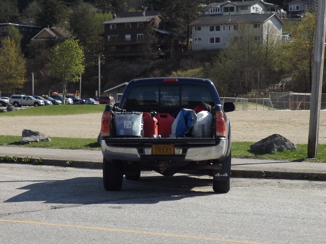 Trucky all loaded up for home |

Exploring
a beach near Greely Point