
The Ronquil aground at Scow Cove
Taku
2014 - 2: Camping Taku Inlet
May 16-18
The Ronquil aground at Scow Cove
 As a kid growing up at the lodge, I flew down the
Taku River
and over its tributary valleys many times, gazing down at the
landscape,
wanting to explore it, dreaming about which valley I’d most like to
live in
when I was older, maybe with a cabin and a pet moose, and a big stack
of firewood
for the winter. I don’t think ever fantasized about living there, but
one
valley in particular charmed me, and it was one that we passed almost
every
single time, a small round cove tucked into a steep, mountain not far
below
Taku and Norris glaciers. Scow Cove, where we looked for black bears in
the
green grassy plain, Scow Cove, which all the pilots flying from the
lodge called
out over the radio: “three five zulu, Scow Cove, 500 feet.”
As a kid growing up at the lodge, I flew down the
Taku River
and over its tributary valleys many times, gazing down at the
landscape,
wanting to explore it, dreaming about which valley I’d most like to
live in
when I was older, maybe with a cabin and a pet moose, and a big stack
of firewood
for the winter. I don’t think ever fantasized about living there, but
one
valley in particular charmed me, and it was one that we passed almost
every
single time, a small round cove tucked into a steep, mountain not far
below
Taku and Norris glaciers. Scow Cove, where we looked for black bears in
the
green grassy plain, Scow Cove, which all the pilots flying from the
lodge called
out over the radio: “three five zulu, Scow Cove, 500 feet.”
As an adult, I’ve passed Scow Cove every time I
went up the
river in my boat, and remembered my fondness for it. But, being not far
from
the cabin but on the other side of the sandbars, I never stopped. Until
this
weekend. Rob, Katie, Chris and I planned a Taku camping trip not to the
cabin,
but up the Inlet. The prevalence of snow up the Taku and the fact that
the tide
was too late on Sunday to get me back to town in time for my niece’s
recital
meant the cabin was not the ideal destination, though we did plan to
stop there
for GPS coordinates and to study the angle form the cabin to the Hughes
Net
satellite for internet.
 It all came together very fast, but the trip was
simple
enough. Rob was kind enough to provide food for the entire weekend. We
met at
the harbor around 6:00, loaded the boat, settled into our familiar
camping
seats, ate Pizzeria Roma pizza, and drank leaving the harbor beers
while
puttering into Gastineau Channel. The evening was stunning and, other
than a
little chop on the way up the inlet, the ride was tranquil. My hope was
to camp
at Scow Cove the first night, but we were already several hours into a
falling
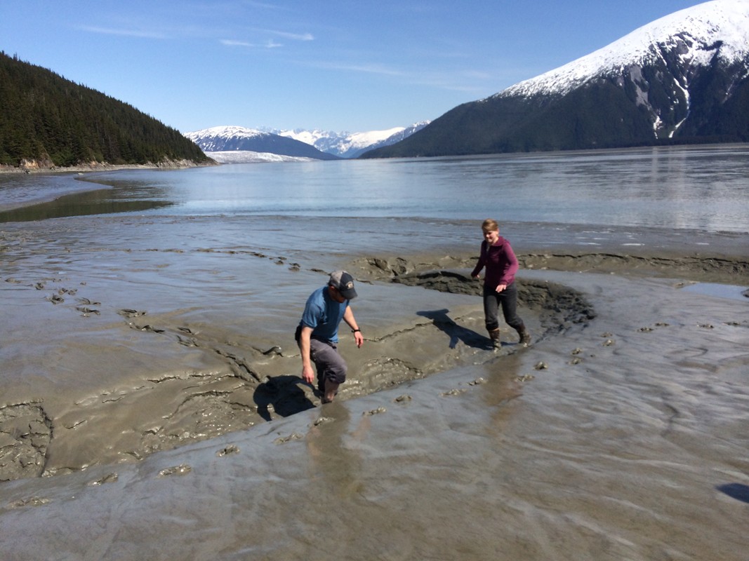
tide and Scow Cove is very much on the river. Around 7:15 we were
gingerly
making our way up an increasingly defined channel along the
mountainside above
Flat Point, then encountered a sloping wall of mud as we came in front
of Scow
Cove. It was an uneasy sight for me, realizing how wide the mud flats
are
between the river and the trees and seeing that I would have to leave
the boat
at the very edge of the current. The large creek flowing from the cove
was
already perhaps six feet below the top of the mud flats and did not
seem a
reasonable place to try the boat. The fact that we touched bottom a
couple of
times in the main channel didn’t help, nor did the fading light.
Nevertheless,
I still wanted to give it a try, and the next order of business was to
make
sure we could even walk on the mud. I pulled up the bank and let Rob
off to
test it, then pushed back into the current and was swept swiftly
downstream
until I started the engine and eased my way back up. The mud was solid
and we
all agreed to give it a try despite our various trepidations. I pulled
the
Ronquil up on the beach toward the upper end of the cove and anchored
it in the
mud; we all dumped a first load of gear from the boat on a small rocky
beach
inside the mud flats before exploring the cove in search of a campsite.
It all came together very fast, but the trip was
simple
enough. Rob was kind enough to provide food for the entire weekend. We
met at
the harbor around 6:00, loaded the boat, settled into our familiar
camping
seats, ate Pizzeria Roma pizza, and drank leaving the harbor beers
while
puttering into Gastineau Channel. The evening was stunning and, other
than a
little chop on the way up the inlet, the ride was tranquil. My hope was
to camp
at Scow Cove the first night, but we were already several hours into a
falling
tide and Scow Cove is very much on the river. Around 7:15 we were
gingerly
making our way up an increasingly defined channel along the
mountainside above
Flat Point, then encountered a sloping wall of mud as we came in front
of Scow
Cove. It was an uneasy sight for me, realizing how wide the mud flats
are
between the river and the trees and seeing that I would have to leave
the boat
at the very edge of the current. The large creek flowing from the cove
was
already perhaps six feet below the top of the mud flats and did not
seem a
reasonable place to try the boat. The fact that we touched bottom a
couple of
times in the main channel didn’t help, nor did the fading light.
Nevertheless,
I still wanted to give it a try, and the next order of business was to
make
sure we could even walk on the mud. I pulled up the bank and let Rob
off to
test it, then pushed back into the current and was swept swiftly
downstream
until I started the engine and eased my way back up. The mud was solid
and we
all agreed to give it a try despite our various trepidations. I pulled
the
Ronquil up on the beach toward the upper end of the cove and anchored
it in the
mud; we all dumped a first load of gear from the boat on a small rocky
beach
inside the mud flats before exploring the cove in search of a campsite.
On the way I worried that I’d made a huge mistake.
The flats
were incredibly wide between the river and the trees and gradually
shifted from
bare mud by the river to sparse and hardy grasses (that improved our
traction
considerably), to intertidal beach grass farther back, all interspersed
with narrow,
deep channels of fresh water coursing to the central stream. All the
while
Cailey romped with abandon, the only one among us who had no doubts
about our
location.
The scene at the back of the cove was less
encouraging than
I’d hoped. Having left Juneau in the wild throws of an early spring,
the air
saturated with spruce pollen and the lush perennials already a couple
of feet
high, it was a bit unnerving to encounter a snow field in front of the
woods,
many of the fringe alders still pinned down beneath it. The forest
inside was
mostly free of snow and dry, but inhabited by dense devil’s club. I saw
a few
places that we probably could have squeezed in our tents, but it wasn’t
very
inviting. We regrouped on the snow fields and pondered our options—even
the
option of sleeping on the snow itself. The creek was too high and brisk
to
consider crossing, but the options on the other side looked no more
inviting.
Then I noticed a grove of tiny spruce trees, each  no
more than a foot
or two
tall, growing between the snow and the edge of the rushing creek.
“Spruce
trees,” I said, “are in no way intertidal, so that means they don’t get
flooded
at high tide!” Or something along those lines. It seemed logical at the
time:
no spruce tree (or alder, for the matter) grows where its roots are
washed with
salt water on any tide.
no
more than a foot
or two
tall, growing between the snow and the edge of the rushing creek.
“Spruce
trees,” I said, “are in no way intertidal, so that means they don’t get
flooded
at high tide!” Or something along those lines. It seemed logical at the
time:
no spruce tree (or alder, for the matter) grows where its roots are
washed with
salt water on any tide.
In fact, the area turned out to be idyllic.
Despite the
nearby snow, the site was dry, and the rushing creek a fine, if
somewhat loud,
companion. The land was quite flat and covered with dead grass. We
quickly
adopted it and returned to the Ronquil for our gear, finding it high
and dry on
the slope of the mud bank. Everyone carried another load back to the
nearby
gravel beach and then consolidated everything into one uncomfortably
large load
each which we laboriously carried across the mud to our campsite in the
diminishing light. I immediately went to my usual task of wood
collection while
Chris set up the tent, choosing a site next to the creek while Katie
and Rob
pitched theirs closer to the snow bank. The woods were delightfully
filled with
dead branches from the young spruces growing up close together around
dying
alders—making me suspect that the forest there is fairly young—but the
trek
through the snow, forcing myself through the tangled web of alders at
the
inside edge, was difficult.
 But at last we had tents up and, with a few more
loads from
the others, a sizable stack of dry firewood. Chris lit a fire with a
pizza box
and beach grass and I trekked back to check on the boat and adjust the
anchor.
In the end, I withdrew some of the line I’d originally put out and
moved the
anchor back from the edge of the cove on the gravel beach and onto the
mud
flats again in the hope that the boat would beach itself out of the
main
current but reasonably close to it (so it would float soon on the
rising tide
the next day), and would come to rest north of the main creek gully,
which
would otherwise threaten to leave it askew on the falling tide (the
boat seems
drawn to creeks as the tide falls). My theory was that the current
would keep
the boat pulling downriver, away from the rocks at the north end of the
cove
despite the rising tide. Near the boat I saw grizzly tracks and another
set of
tracks which I suspected were river otter, both washed with at least
one tide.
I hoped my positioning would work, but the boat was then below the mud
banks
and so could not be seen from the campsite, so I would be unable to
monitor it
from a distance.
But at last we had tents up and, with a few more
loads from
the others, a sizable stack of dry firewood. Chris lit a fire with a
pizza box
and beach grass and I trekked back to check on the boat and adjust the
anchor.
In the end, I withdrew some of the line I’d originally put out and
moved the
anchor back from the edge of the cove on the gravel beach and onto the
mud
flats again in the hope that the boat would beach itself out of the
main
current but reasonably close to it (so it would float soon on the
rising tide
the next day), and would come to rest north of the main creek gully,
which
would otherwise threaten to leave it askew on the falling tide (the
boat seems
drawn to creeks as the tide falls). My theory was that the current
would keep
the boat pulling downriver, away from the rocks at the north end of the
cove
despite the rising tide. Near the boat I saw grizzly tracks and another
set of
tracks which I suspected were river otter, both washed with at least
one tide.
I hoped my positioning would work, but the boat was then below the mud
banks
and so could not be seen from the campsite, so I would be unable to
monitor it
from a distance.
The fire was a cheery sight on my trek back across
the mud.
We formed an arc of chairs around one side, with a blanket for Cailey,
overlooking
the flats and the river, and drank wine, cider, beer, and rum and
cokes, each
to our own tastes, as we chatted into the night. Around midnight we
retired. I
was a little chilly and so slept restlessly for a few hours. At 2:50 I
awoke to
the sounds of the first dawn bird song—a Lincoln’s sparrow—followed by
varied
thrushes. I must have fallen asleep immediately after hearing those,
for I
awoke five minutes later as Rob called us, asking very casually if we’d
looked
out the tent recently; when we said no, he responded “It’s worth a
look”--again,
ever so casually.
Water!
With 15 minutes until the high tide in
Juneau, the
rising waters had flooded most of the mud flats and backed up the creek
until
it had begun to overflow its banks (the creek had been around 18”-2’
below the
bank in our area when we’d arrived). It wasn’t immediately obvious that
water
had reached our tent, but it seemed wise to check it out, so I suited
up and
stepped out. My boots squished as I walked around the lower side of the
tent,
so we decided we’d better move to higher ground. Chris got up and we
drug
everything intact up next to Rob and Katie’s tent, which was clearly
going to
survive the flood. Our camp chairs made a comical image, standing in
several
inches of water in front of a floating mess of charcoal and unburnt
sticks. The
good news was that we could see the boat floating nicely at the edge of
the
cove.
 Chris imitates Cailey |
 Katie at the edge of Scow Cove |
 Rob and Chris loading gear |
You can just see the campfire inside the cove from here |
 Flooded chairs! |
 We move the tent... |

 I
woke
up at 7:30 and decided to go ahead and get up to check on the boat. If
I’d
realized that I could now see the boat from our campsite, I probably
would have
merely poked my head out the tent and continued to snooze, but I didn’t
know
that until I was up and dressed. Cailey and I walked down to the
Ronquil, which
could not have settled down on the mud into a more perfect position—it
was
exactly what I’d hoped would happen. The sky was covered in a high,
hazy
overcast and everything felt very still and calm. I stopped by the
alder fringe
on the way back for a small armload of wood and found Rob up when I
returned to
the campfire. Soon we were all up and about, enjoying the warm morning
and wide
mud flats again stretching before us. Rob picked up breakfast supplies
from the
boat and cooked amazing bacon and flapjacks over Chris’s double burner
camp
stove while we drank coffee sweetened with maple syrup around a small
campfire.
My dream of a leisurely camp morning was coming true!
I
woke
up at 7:30 and decided to go ahead and get up to check on the boat. If
I’d
realized that I could now see the boat from our campsite, I probably
would have
merely poked my head out the tent and continued to snooze, but I didn’t
know
that until I was up and dressed. Cailey and I walked down to the
Ronquil, which
could not have settled down on the mud into a more perfect position—it
was
exactly what I’d hoped would happen. The sky was covered in a high,
hazy
overcast and everything felt very still and calm. I stopped by the
alder fringe
on the way back for a small armload of wood and found Rob up when I
returned to
the campfire. Soon we were all up and about, enjoying the warm morning
and wide
mud flats again stretching before us. Rob picked up breakfast supplies
from the
boat and cooked amazing bacon and flapjacks over Chris’s double burner
camp
stove while we drank coffee sweetened with maple syrup around a small
campfire.
My dream of a leisurely camp morning was coming true!
After eating and lounging around, Katie did the dishes and I decided to make a quick exploration up the creek. The short valley behind camp (rising quickly up the mountain) made for dramatic rock displays: steep granite/diorite cliffs on the sides and a rounded, degraded promontory at the back. The creek rushed down the valley, not slowing in the 100 yards or so of it that I saw. There were openings along the bank not far up which looked to be alder meadows once the snow melted. It was beautiful with the big trees surrounding the openings and the cliffs behind, but I could see that it would be tough going in summer. The soft snow and unpredictably pinned alders made tramping around hard enough.
Back at camp I took our gear out of the tent and turned everything upside down along with the tent to let them dry out from their slight dousing the night before. Katie and Rob disappeared downstream in an apparent attempt to cross it. Chris and I watched as they rejected repeated crossing options, then donned our sandals and waded across a riffle near the campsite. The water was up to our knees at the deepest place. Then we raced down the opposite side to taunt Katie and Rob, who soon crossed a riffle close to the mouth in xtratuffs; Katie kept her feet dry, but Rob’s shorter xtratuffs failed him.
 Having
crossed the major hurdle, we skated across the slick mud toward the
sheer
cliffs on the south side of the cove, precariously sliding into every
little
slough we crossed. We found a tiny live eel-like creature on the mud,
which I
deposited in a puddle, as well as
Having
crossed the major hurdle, we skated across the slick mud toward the
sheer
cliffs on the south side of the cove, precariously sliding into every
little
slough we crossed. We found a tiny live eel-like creature on the mud,
which I
deposited in a puddle, as well as  some
strange skid marks that Katie
and I
followed to their apparent origin near the cliff face, without
resolving their
origin. Once there, we found one section of cliff that rose almost
vertically
from the mud, a towering face that looked enticing to climb (though I
was
unable to even start with my mud-filled sandals). Meanwhile, Chris and
Rob had
round a jumble of rocks and crevasses nearer the river; Chris and
Cailey were
perched like mountain goats near the top and Katie soon seated herself
in what
can only be described as a massive stone throne!
some
strange skid marks that Katie
and I
followed to their apparent origin near the cliff face, without
resolving their
origin. Once there, we found one section of cliff that rose almost
vertically
from the mud, a towering face that looked enticing to climb (though I
was
unable to even start with my mud-filled sandals). Meanwhile, Chris and
Rob had
round a jumble of rocks and crevasses nearer the river; Chris and
Cailey were
perched like mountain goats near the top and Katie soon seated herself
in what
can only be described as a massive stone throne!
We lingered in the area for a while as the final
haze of the
morning burned away, revealing a stunning blue sky, and then slipped
our way
back across the many small sloughs and across the main creek bed. Chris
swung
by the boat and picked up a beer each, then met us on some comfortable
rocks on
the north side of the cove for a drink in the sunshine. Eventually we
made our
way back to camp and packed everything up in a leisurely fashion,
arriving back
at the boat just as the rising tide was beginning to surround it. I
lagged
behind and by the time I arrived the tide had already risen
considerably since
the others had arrived. Old hats by this time, we quickly stowed our
gear
appropriately, then I ran back to the gravel beach to grab the anchor
before
the little tributary sloughs filled with too much water to cross (the
main
creek channel was far too deep to cross now) and Rob followed to grab
the dingy
and paddle we’d stashed in the woods in case we needed to retrieve the
boat at
high tide. Back at the boat I dropped the anchor with a short leash and
we at
Rob’s brilliant lunch in the sunshine as the tide continued to rise
around us.
He provided Chris with a pepperoni sandwich and me with a smoked salmon
sandwich, rounded out with an apple, chips, pretzels, and granola bars.
We ate
and I for one felt pretty satisfied with our first camp site.
But we were hardly up the Taku yet. I had two
missions to
accomplish at Bullard’s Landing, so we headed upriver as soon as we
were
finished with dinner. By this time it was 2:00 and two hours to high
tide, but
on top of the rising water, the river was extraordinarily high and
there were
no sandbars to be seen. We passed Grizzly Bar on the left and Hut Point
on the
right, then hugged the cliffs as we headed toward the flats. We hit a
log on
the way that was below the surface, but didn’t seem to sustain any
damage and
continued on our way. The river and the valley were sparklingly
beautiful with
the clear blue sky and the glassy high water.
For a spring presentation, I couldn’t have asked it to be more
picturesque for Katie and Rob, both new to the Taku. We arrived at the
beach steps
with no further incident, tied up the boat, and immediately walked
downriver to
the guest cabin. I used the outhouse, then took GPS locations at the
USFS
marker near the cabin and at the nearby waterfront. The ground was bare
inside
the trees, but still several feet deep in open areas.
From there we headed up to cabin, seeing huge wolf
tracks in
the snow (they were fresh enough that Cailey pressed her snout into
them to
sniff). Most of the meadow around the cabin itself was bare of snow,
though not
yet green. I opened the cabin and the shutters on the picture window
(after
shutting some of the other shutters that had blown open over the
winter) and
gave Rob and Katie a quick tour before heading onto the porch upstairs
to take
some pictures in the direction of the mountain to the south and try to
determine
how far above the horizon they are. The Hughes Net satellite is 24.5
degrees above
the horizon, so I was trying to determine whether we had a clear shot.
Unfortunately, I’d left my angle measure at Snettisham, so I didn’t
have the
right tools at hand. The mountain top due south was visible, but trees
grew to
either side and I couldn’t determine their angle above the horizon
there. So I
made do with photos, which I repeated from ground level. Then we all
headed
upriver for mission #2: complete riverside GPS coordinates of the
property
boundary.
I in no way expected this task to be so difficult.
I
imagined following a clear path over the snow along the trail all the
way to
the meadows above. We did manage to make it past Debbie’s meadow with
no
problem, but the snow was four or five feet deep in most places and
soft, so
the going was slow and Chris was particularly uncomfortable in sandals
(I’d
retreated into my xtratuffs at the boat). He turned back at the meadow
and was
wise to do so. The rest of us pushed on upriver, but the trail quickly
proved
nearly impossible to find or follow. The alders and willows at its
sides were
bent over and pinned to the snow, so the snow on the trail looked
identical to
the snow in every other opening in the forest, which were many. I
suspect we
barely touched the trail on the way upriver, and knew we were
hopelessly off of
it when I saw the river through the trees (the trail in that area is
never
close to the river). It was an unpleasant struggle, but we eventually
broke
through into the beginnings of the meadow, snow free, and quite close
to the
young cottonwood that marks the northwest corner of the property.
Within
seconds, Rob had spotted the USFS boundary marker under an alder and I
took its
position, then the nearby position of the top of the riverbank, then
the
position of the edge of the water where, at lower tides/water levels,
the
grassy marsh begins. I have a theory
that that marsh is reclaiming the land that was washed away in the last
century
by the river (which has now changed course and no longer erodes that
area), as
the current northwest corner of Bullard’s Landing is a full 240’ closer
to the
mountain than it was in 1916.
We wandered upriver just a little to show Katie
and Rob the
meadows and the view of the glaciers, then retreated back to the cabin.
Thankfully I was able to find the trail since I knew where it would
begin from
the meadows and only had one major misdirection in the middle, during
which Rob
found the trail and bailed us out. Thus, the trip back was shorter and
more
enjoyable. We lingered at the cabin a little longer while I took a few
more GPS
coordinates, then returned to the boat and headed downriver. Given the
high
water, we certainly could have overnighted and been able to leave early
enough
the next day to make my 6:00 commitment in town, but we already had
other plans!
There was another valley to explore.
And so we sailed down the glorious Taku River,
back past Scow
Cove (now flooded again with high tide) and along the waterfall-strewn
shoreline beyond. I had to fuel up near the Annex Creek power station
just off
a lovely waterfall, but before we knew it we were pulling into Sunny
Cove, our
campsite for the night. I dropped everyone off and then made long,
drawn out,
agonizing attempts to anchor the boat. I didn’t know the anchorage very
well
and was trying to use my fathometer to puzzle out the best location.
But it was
giving me puzzling and suspiciously low readings, even after adjusting
it a few
times underwater. I finally settled on my spot and then proceeded to
make one
attempt after another to set the anchor. It seemed unwilling to catch
no matter
how much line I put out and I made several attempts before I was
finally
satisfied that it caught. Chris had inflated the Howard Moon before I’d
gone to
anchor, so I made sure to shut off the fathometer, grabbed the cheese
per Rob’s
request, and dropped into the dingy. The trip to shore—which seemed
quite far
despite the fact that I was only anchored in ten or twelve feet of
water—was a
little harrowing, partly because there was a small leak in the bottom
of the
raft just in front of my knees, and partly because I’d forgotten the
oars and
so was paddling awkwardly with a single broken paddle. In any event, my
legs
were wet when I got to shore and I was a bit stressed out.
Thankfully, others took care of everything for the rest of the evening. Chris already had the tent set up, and beers were cooling in the snow, so I de-stressed with a little wood gathering. Everyone pitched in on this, and Chris found a stash of cut limbs from power line trimming which he and Rob pilfered with great success. After a little wood gathering, I gratefully settled down with a drink around the fire on the beach. This campsite was much more what we were familiar with—a saltwater/tidewater beach where we could set our chairs on the sand below the high tide line and build a fire that would wash away with a flood tide in the near future. There was also a fringe of snow between the high tide line and the forest, but it had melted away enough to reveal a strip of dry, dead grass perhaps 12’ wide for us to pitch our tents on. Carlson Creek rushed toward the ocean in front of our campsite and just upstream were the remains of the pilings that once support Taku Packing Company’s plant. Built in 1900 by John Ludwig Carlson, the plant is one of the properties I’m investigating in my historical research, as Carlson had both Snettisham properties surveyed in 1902 and is the only person I know who is associated with my Snettisham property, which remains largely mysterious.
 But
first there was dinner to consider. Once again, Rob outdid himself
with
Katie as sous chef. We feasted on pasta with fresh cheese and olive
oil,
veggies grilled over the campfire, and garlic bread. We ate with gusty
as the
sun slowly retreated down the long valley to the west. That evening I
did make
a short foray into the woods above the pilings, discovering many strips
of
metal in various degrees of decay, old stove legs, an iron stove or
possibly a
retort, a couple of wooden boxes that we later agreed were small animal
traps,
and many more animal remains. Katie had already found the remains of a
porcupine, most of which I’d placed in a tree away from Cailey’s reach
(though
she’d found the skull which I threw into the water), and Chris found
some large
vertebrae; here there were more bones, two deer skulls (one with the
antlers cut
off, which suggests to me that it is an area frequented by hunters),
and the
remains of several birds, which made me wonder if an accipiter
frequented the
area. I also noticed that that there were more piling-like stumps in
the forest
and what looked like an artificial rock wall above the beach. While the
antiquity of some of the items was in question, there was no doubt that
the
older iron artifacts are from the cannery as well as the pilings.
But
first there was dinner to consider. Once again, Rob outdid himself
with
Katie as sous chef. We feasted on pasta with fresh cheese and olive
oil,
veggies grilled over the campfire, and garlic bread. We ate with gusty
as the
sun slowly retreated down the long valley to the west. That evening I
did make
a short foray into the woods above the pilings, discovering many strips
of
metal in various degrees of decay, old stove legs, an iron stove or
possibly a
retort, a couple of wooden boxes that we later agreed were small animal
traps,
and many more animal remains. Katie had already found the remains of a
porcupine, most of which I’d placed in a tree away from Cailey’s reach
(though
she’d found the skull which I threw into the water), and Chris found
some large
vertebrae; here there were more bones, two deer skulls (one with the
antlers cut
off, which suggests to me that it is an area frequented by hunters),
and the
remains of several birds, which made me wonder if an accipiter
frequented the
area. I also noticed that that there were more piling-like stumps in
the forest
and what looked like an artificial rock wall above the beach. While the
antiquity of some of the items was in question, there was no doubt that
the
older iron artifacts are from the cannery as well as the pilings.
Despite a certain exhaustion, the fire and the company was so fine that
I
lingered on the beach longer than I normally would, finally retreating
about
11:30. Cailey’s exhaustion was clearly showing in her face, but she
remained
unwilling to relax if anything of the least interest took place around
her. In
the tent I expected her to curl into blissful sleep immediately, but
she was so
far gone that she stared with her eyes open for a long time as though
she’d
passed beyond her ability to rest. In the middle of the night, after
she’d
slept some, she seemed much more normal.
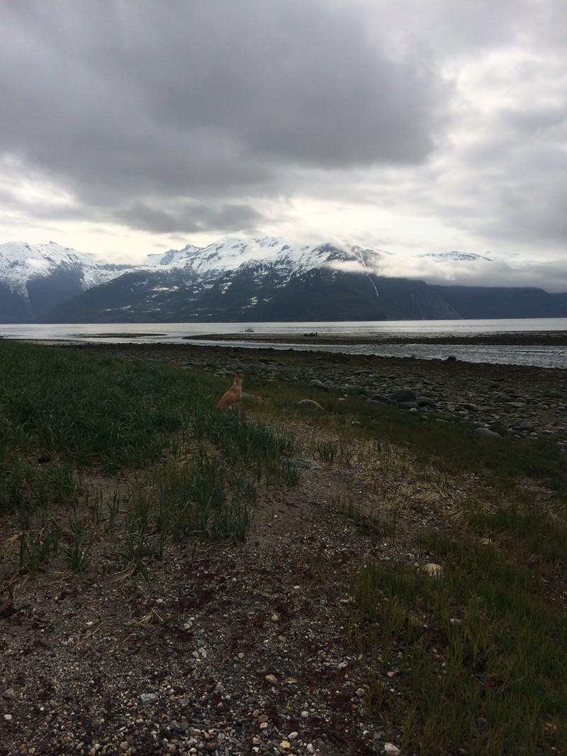
 Early morning in Scow Cove |
 The Ronquil perfectly positioned |
 Rob cooks bacon and flapjacks |
 Our relocated tent site |
 Enjoying coffee |
 Look at Cailey! |
 Breakfast at camp |
 Rob and Katie slide across a slough |
 Cool eel-like creature |
 Cliffs of Scow Cove |
 ....... |
 Mountain goat Cailey |
 Rob and Katie crossing the creek |
 Packing up camp |
 Just north of Bullard's Landing |
 View from the corner of Bullard's Landing |
 More familiar salt water beach camping |
 Campfire and dinner! |
 Rob and Katie's tent |
 The Ronquil goes aground across the creek |
 Curious timbers on the beach |
 Pilings of the Taku Packing Company's cannery |
 Pilings continue into the forest |
 Another view of the dock pilings |
That morning I’d broken out my new metal detector for the first time and had wandered down the beach toward the curious remains near our tent. The results were unclear, not surprising since I’d barely read the directions, let alone tested it out. Beeps of various tones were frequent and inconsistent, and it didn’t help that I had nothing to actually dig with. In one place where I was getting a lot of sound I kicked around with my heel and unearthed an old sterno can; I came back to camp triumphant with my proof of concept, if not a very interesting artifact.
So when we headed upriver to the cannery ruins, I was happy to have the metal detector along, but also happy to have someone other than myself wield it, as I could see that I needed more experience, that we would be lost without a shovel, and that there would probably be so much iron debris around that it would be hard to pinpoint anything exactly. Rob took it on the first leg and eventually sacrificed his mug when he finished his coffee to use as a digging tool. He dug down about 18” at one spot, scouring the dirt periodically to see if we’d shoveled anything out, and we eventually found an old pop can. Another proof of concept! I imagine it’ll be more fun in places with less persistent trash.
At
the
cannery ruins, we saw that the pilings in the woods (most no more than
a foot
or two tall) covered a very broad area and were in tidy rows, some with
rebar-type
iron sticking out of them. It looked like the whole structure was built
up off
the ground. We also  found a large, half buried circular piece of iron
(definitely
historic--see photo to left) and a lot more angle pieces which we
suspect were left from
the power
lines. Later I looked at the 1902 survey and saw that the cannery
complex was
indeed built right behind the dock. There were several other buildings,
but I
suspect whatever remained of them were destroyed by the power lines
that run
right through the property just behind what once was the cannery.
found a large, half buried circular piece of iron
(definitely
historic--see photo to left) and a lot more angle pieces which we
suspect were left from
the power
lines. Later I looked at the 1902 survey and saw that the cannery
complex was
indeed built right behind the dock. There were several other buildings,
but I
suspect whatever remained of them were destroyed by the power lines
that run
right through the property just behind what once was the cannery.
From there we wandered along the creek bank upriver searching for the cabin of the Taku Tlingit who’d sold John Carlson his cabin and moved upcreek three or four hundred yards from the cannery site. Rob paced it out and we found several lovely looking places for a cabin, but there was no evidence of it. If there was anything remaining it could easily have been under the snow or, again, demolished by the power lines or the people who built them. Or, long rotted into the land around it.
I was feeling pretty lethargic and not anxious to brave the Howard Moon again to retrieve the Ronquil, but soon it looked to be floating and the water was calm, so I slowly donned a life jacket and carried boat and paddle to the shore. With the incoming tide moderating the creek’s current, the float across and down to the boat was pleasant, the water boiling around me as the air in the mud flats escaped. I leisurely fueled up, pulled anchor, and puttered in to shore as the others began to tear down the tents. It was about the most leisurely and relaxed boat retrieval I can remember.
 We
slowly finished packing up and loaded the boat, pulling off the beach
at 2:00.
Cailey immediately curled up and went to sleep. The inlet was flat calm
and
hazy—the kind of wash of rainless white that depresses me on land, but
feels
wonderful and alive on the water. We went straight over to Was’as’e,
the great
scar below Jaw Point, and slowly puttered past the cliffs as Rob gave
us
insight into its structure and makeup. It was the breeding season and
glacous-winged gulls dotted the cliffs on their nesting sites—some
preening,
some sleeping, some wheeling about. Since the tide was rising, we idled
past
the cliffs, then drifted back while we ate a lunch just as delicious as
that of
the day before, starting up the engine a few times to avoid collisions
with the
rocks.
We
slowly finished packing up and loaded the boat, pulling off the beach
at 2:00.
Cailey immediately curled up and went to sleep. The inlet was flat calm
and
hazy—the kind of wash of rainless white that depresses me on land, but
feels
wonderful and alive on the water. We went straight over to Was’as’e,
the great
scar below Jaw Point, and slowly puttered past the cliffs as Rob gave
us
insight into its structure and makeup. It was the breeding season and
glacous-winged gulls dotted the cliffs on their nesting sites—some
preening,
some sleeping, some wheeling about. Since the tide was rising, we idled
past
the cliffs, then drifted back while we ate a lunch just as delicious as
that of
the day before, starting up the engine a few times to avoid collisions
with the
rocks.
After lunch we found ourselves unable to get back up to speed and discovered a large log stuck between the engine and the boat. Rob pushed it out and we were underway for one last stop on the trip at a possible location for the Point Greely Tlingit village. There are only a couple of possible beaches near Point Greely, and the one we chose for a quick pit stop was far too cliffy to be a likely candidate. We wandered around for about five minutes, then kicked off the beach again. That led me to believe that the village site is a little farther south in a very nice little cove with a creek running down—unfortunately also the place where the power lines from Snettisham and Dorothy Lake join and cross Taku Inlet, which means that any remains of a village have probably been destroyed.
But that would have to be an exploration for another time! We crossed the inlet and cruised uneventfully up Gastineau Channel, quickly and efficiently unloading a very silty boat and going our separate ways towards showers and the week ahead.
 Cailey watches Rob walk to the boat |
 Rob returns with breakfast |
 Breakfast! |
 Stove? |
 Rock retaining wall (?) at the edge of the ruins |
 Porcupine sign! |
 Carlson Creek |
 Nesting gulls on the cliffs of Was'as'e |
Was'as'e |
