June 13-17, 2012

Iceberg near the Big Bend
Tracy
Arm - Days 1-2
June 13-17, 2012
Iceberg near the
Big Bend
 Tracy
Arm. All my friends have heard me wax
rhapsodic
about its spectacular beauty--the sheer 1,000 foot cliffs,
hundreds of
plummeting waterfalls, U-shaped valleys, hanging glaciers, sky blue
ice, stunning tidewater glaciers, brilliant wildflowers erupting from
rock crevasses--not to mention mountain goats, pupping
harbor
seals, barnacle-eating bears, etc. I've shepherded thousands of
tourists
to Tracy Arm and no one came back disappointed. For myself, I've
been in
there about 75 times and it never failed to impress me.
Tracy
Arm. All my friends have heard me wax
rhapsodic
about its spectacular beauty--the sheer 1,000 foot cliffs,
hundreds of
plummeting waterfalls, U-shaped valleys, hanging glaciers, sky blue
ice, stunning tidewater glaciers, brilliant wildflowers erupting from
rock crevasses--not to mention mountain goats, pupping
harbor
seals, barnacle-eating bears, etc. I've shepherded thousands of
tourists
to Tracy Arm and no one came back disappointed. For myself, I've
been in
there about 75 times and it never failed to impress me.
But wouldn't it be great if I could visit it on my own terms, in my own
boat?? In my adult life I'd only been there in a tour boat,
dreaming of coming
back and
exploring with my skiff. This year I finally made it
happen! Chris
and I have taken the Ronquil farther
afield than Tracy Arm, but always
with a
place to refuel along the way. One of the challenges of Tracy Arm
is the
lack of anywhere to pick up more fuel, not to mention a dearth of
anchorages, so this trip threw up new logistical issues.
We chose a weekend and started planning with our companions, Katie and
Rob.
Part of
the process for me involved estimating gas consumption, then purchasing
and ferrying extra jerry jugs of gas to
Snettisham to stage them, which I accomplished on earlier trips
down. Rob and Katie generously agreed to provide food for the
entire trip. The final itinerary had us overnighting at the
homestead
the first
night, then heading to Tracy Arm for two nights, and overnighting back
at the
homestead on the way home.
My biggest fear, of course, was
weather.
We left the harbor at about 6:00 pm Wednesday night and had a smooth
ride down
the channel--I was in high spirits and made too many comments about how
splendid an evening it was. My delight diminished at the end of
the channel when we began running into chop,
seas which
built slowly over the next hour until we were bucking occasional
three
footers as we neared Snettisham. But it wasn't anything alarming
and,
during the uncomfortable moments, I remembered that I'd much rather hit
seas on
this leg of the journey than along the Snettisham Peninsula the next
day.
We passed two whales at the mouth of Taku Harbor and lots of loons in
Snettisham. The water at the homestead was glassy calm. The
four of
us ate dinners brought from home (Chris had run by Subway on the way to
the
harbor) and chatted into the evening. That night a heavy rain
started,
splattering on the metal roofs.
The next morning we met at the lodge around 8:30, had some instant
oatmeal and
coffee drinks for breakfast, and packed up our gear for the ride to
Tracy
Arm. We left at about 9:30 in a dense rain, cruising quickly out
of the
port and into Stephen's Passage (our morning "leaving the harbor
beers" replaced by swigs of Irish cream from Chris's flask).
The seas were quite mild--one or two feet--and we made it all the way
down to
Point Coke (the entrance to Holkam Bay) in less than an hour.
I
thought I might have spied orcas in the distance closer to Admiralty
and gazed
in that direction for a few minutes, but never confirmed it. I
told everyone
what I remembered about the Little Ice Age as we approached the two
buoys that
mark the old terminal moraine of the Sawyer Glacier. Ice bergs
dotted the
bay and clouds obscured Sundum Glacier. We quickly caught up with
a
cruise ship that had entered a bit before us and were disturbed to
smell grease
and food as we passed their stern. We stopped at the cliffs
across from
Williams Cove to look for wildlife and, finding none, continued along
the
coast. The consistently rainy weather for nearly all of May and
June up
to that point had the waterfalls roaring in rare form. About half
a mile
from the Big Bend I spotted something black on the beach and was
thoroughly
delighted to discover that it was, as hoped, a black bear eating
barnacles
and/or other invertebrates on the rocks! Classic Tracy Arm.
This
bear was jet black, too, beautiful. We also stopped for a
stunning blue
ice berg and I told everyone about the shape of icebergs and how you
can see
the angle at which they used to lay in the water (for some reason I am
endlessly fascinated by this!).
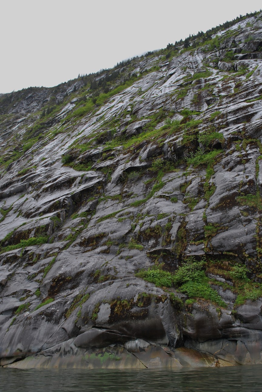
 And then we were around the Big Bend, where I'd
promised everyone the
scenery become more spectacular (Rob had been in Tracy Arm twice on the
Adventure
Bound, but neither of the other two had been there at
all). We
followed
the right shoreline along the sheer cliffs, admiring the smooth scour
marks
left by the glacier, the colorful intertidal zone, and the many many
waterfalls
pouring down the face, some misting out below overhangs before joining
again
with the rocks below. We had a wonderful look at a single small
seal
below the cliffs. At that point my camera stopped turning on and
I was
thankful Chris had brought his (mine was brand new). I
tried the
two spare batteries, but to no avail.
And then we were around the Big Bend, where I'd
promised everyone the
scenery become more spectacular (Rob had been in Tracy Arm twice on the
Adventure
Bound, but neither of the other two had been there at
all). We
followed
the right shoreline along the sheer cliffs, admiring the smooth scour
marks
left by the glacier, the colorful intertidal zone, and the many many
waterfalls
pouring down the face, some misting out below overhangs before joining
again
with the rocks below. We had a wonderful look at a single small
seal
below the cliffs. At that point my camera stopped turning on and
I was
thankful Chris had brought his (mine was brand new). I
tried the
two spare batteries, but to no avail.
From there we cruised by Icy Falls and gazed up at the obvious entrance
to
Icefall Lake, a potential hike we'd heard about--it would be a fun
scramble up
there, but there was no protected place to leave the boat. We
continued
cruising along below the sheer cliffs beyond Icy Falls, passing a pair
of seals
on the point. I was particularly delighted to finally have the
chance to
go at my own speed, stop when I wanted to, gazing up the rock with
intimacy
lacking on a larger boat. At some point we ran out of gas--right
on
schedule--and instead of switching tanks I decided to fuel up.
This was
an awkward endeavor, as all our packs were laid across the back bench
and
covered in a tarp, but the water was calm and I don't even think it was
raining
at that point (rain had been intermittent since we entered Holkam
Bay).
The freedom of the small boat and having no schedule was wonderful; for
example, we sped by a couple of strange holes in the rock and I turned
around
to check them out. When do you ever get to do that on a tour
boat?!
Rob explained that they were areas of weaker rock wearing away.
It was a
pleasure to have a geologist on board to point out the dikes and
intrusions and
other easily accessible geological features (easily accessible for
us--Rob saw
much that was beyond the rest of us).
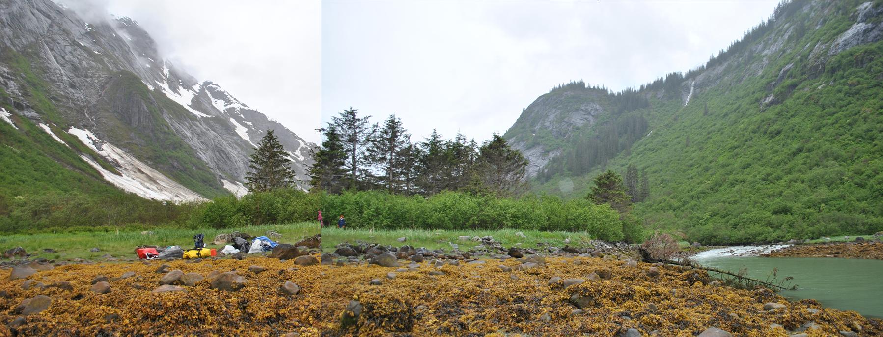
And at last we turned the corner and came in sight of the second
U-shaped
valley and, a few moments later, the first. Our plan was to camp
in one
of the three valleys there, wherever we liked the prospects most,
primarily
based on acceptable moorage for the boat. The first valley looked
better
than I could have hoped for. There was a stony beach alongside a
rushing
creek, above which a meadow begged us to camp. Heartened, we
moved to the
next valley, somewhat less inviting. Its creek descended through
what
appeared to be a waterfall, or at least a steeply graded gorge, still
covered
in a snow bank. The shoreline was steep rock for some height
before the
valley leveled out and there did not appear to be a decent place to
moor.
That was a disappointing find, as we'd hoped to explore that valley
which hides
a lake not far from the fjord. The third valley was perched
strangely
above the waterline; if sea level were perhaps 100 feet higher, we'd
cruise
right up to the edge of it. As it was, we brought the boat onto a
rocky
intertidal zone, above which scrub grew on the rocks at about a 45
degree angle
until, perhaps 100 feet up, the valley appeared to flatten out.
Its creek
raged through a gorge nearby. Rob and Katie hiked the highest
through the
brush, but never reached the lip of the valley or, if they did, were so
deep in
the brush that they didn't see anything. There were few if any
evergreen
trees, the primary foliage being Sitka alder, ferns, salmonberries, and
other
scrub. I did find a pile of deer scat, which was quite
intriguing!
The valley looks like fantastic forage in the summer time, but surely
couldn't
support deer in the winter--where had the deer come from, and where did
they
go? They couldn't have made it up the fjord, so they must have
come in
from the back of the valley, but I pictured it surrounded by snow and
ice. Very puzzling! Possible names for this valley
developed from
more typical choices into "Scat Valley." While they hiked, the
Caption Cook or the Adventure Bound passed by on the
way home, causing
a wake
from across the fjord that threatened to rock the boat against the
rocks; Chris
and I held her off, confirming my discomfort at the anchorage there.
 What surprised me most was the sandy beach at the
bottom of the rocks,
which got
wider as the tide dropped. We sat on the rocks and ate lunch,
gazing out
at the sheer gneiss cliffs across the fjord. Katie and Rob had
packed
wonderful lunches for us all, tidily packed in a
large
ziplock for each couple each day. Cailey ate her lunch on the
rocks as
well. When we were ready to move on it was mid-afternoon and we
decided
to press on to the glaciers that night rather than go back to camp (the
first
valley was the only valley at which I felt comfortable mooring the
Ronquil, and
appeared to have the easiest camping places as well). We sped
around the
corner, passing the cruise ship on her way out (apparently there were
lots of
waving passengers) and began dodging widely-spaced ice bergs.
Soon we
were approaching Marguerite (a.k.a. Sawyer) Island and the junction at
which
you can see both the Sawyer and South Sawyer Glaciers. But.....we
pressed
on and passed the island without ever seeing the Sawyer Glacier!
It had
finally happened....the Sawyer Glacier (often called North Sawyer) had
at last retreated out of sight of the Tracy Arm junction. The
South
Sawyer also
seemed farther away, but I could recognize the rocky point where it was
nearly
stationary the years that I frequented it (2000-2001). An Allen
Marine catamaran
was leaving the glacier, so we maneuvered into its wake, thinking that
it would
provide easy passage through the ice. There wasn't really a trail
to
follow, but the ice on the right side of the fjord was widely spaced
enough
that we could pick our way through, largely at speed. I told
everyone
that we should keep an eye out for seals and we soon passed our first
resting
harbor seal. And then we were alongside pack ice to the left and
there were seals everywhere! We slowed down and picked our way
forward at
the edge of the ice, watching several seal mothers and their young pups
What surprised me most was the sandy beach at the
bottom of the rocks,
which got
wider as the tide dropped. We sat on the rocks and ate lunch,
gazing out
at the sheer gneiss cliffs across the fjord. Katie and Rob had
packed
wonderful lunches for us all, tidily packed in a
large
ziplock for each couple each day. Cailey ate her lunch on the
rocks as
well. When we were ready to move on it was mid-afternoon and we
decided
to press on to the glaciers that night rather than go back to camp (the
first
valley was the only valley at which I felt comfortable mooring the
Ronquil, and
appeared to have the easiest camping places as well). We sped
around the
corner, passing the cruise ship on her way out (apparently there were
lots of
waving passengers) and began dodging widely-spaced ice bergs.
Soon we
were approaching Marguerite (a.k.a. Sawyer) Island and the junction at
which
you can see both the Sawyer and South Sawyer Glaciers. But.....we
pressed
on and passed the island without ever seeing the Sawyer Glacier!
It had
finally happened....the Sawyer Glacier (often called North Sawyer) had
at last retreated out of sight of the Tracy Arm junction. The
South
Sawyer also
seemed farther away, but I could recognize the rocky point where it was
nearly
stationary the years that I frequented it (2000-2001). An Allen
Marine catamaran
was leaving the glacier, so we maneuvered into its wake, thinking that
it would
provide easy passage through the ice. There wasn't really a trail
to
follow, but the ice on the right side of the fjord was widely spaced
enough
that we could pick our way through, largely at speed. I told
everyone
that we should keep an eye out for seals and we soon passed our first
resting
harbor seal. And then we were alongside pack ice to the left and
there were seals everywhere! We slowed down and picked our way
forward at
the edge of the ice, watching several seal mothers and their young pups
 resting
together. In the distance, the pack ice was littered with black
dots. About a mile from the face, the ice was too thick for easy
maneuvering
and we shut down between ice bergs for a few brief spells to enjoy the
glacier
and the seals. The glacier calved on and off around a large,
precarious pinnacle,
rumbling satisfyingly. I was a little shocked to see that land
had
emerged from beneath the glacier! A narrow vein of deep
blue-green
ice
separated the left edge of the South Sawyer from a rocky mass, still
covered on
top by ice. And suddenly the deep blue we always saw on that side
of the
glacier made sense--the densest ice is the deepest in color, sometimes
even greenish;
squished between the fjord wall and this rock, the ice in that area was
extra
compressed, coloring it an intensely.
Wow. Whether that rock is another Marguerite Island or the
beginning of
the end has yet to be seen.
resting
together. In the distance, the pack ice was littered with black
dots. About a mile from the face, the ice was too thick for easy
maneuvering
and we shut down between ice bergs for a few brief spells to enjoy the
glacier
and the seals. The glacier calved on and off around a large,
precarious pinnacle,
rumbling satisfyingly. I was a little shocked to see that land
had
emerged from beneath the glacier! A narrow vein of deep
blue-green
ice
separated the left edge of the South Sawyer from a rocky mass, still
covered on
top by ice. And suddenly the deep blue we always saw on that side
of the
glacier made sense--the densest ice is the deepest in color, sometimes
even greenish;
squished between the fjord wall and this rock, the ice in that area was
extra
compressed, coloring it an intensely.
Wow. Whether that rock is another Marguerite Island or the
beginning of
the end has yet to be seen.
As we drifted between bergs,
repositioning
now and then to avoid hitting the bigger ones, we heard some calving
and looked
over in time to see the entire pinnacle come down in a great
crash. A
minute or so later we felt the swell. Nearby we enjoyed watching
a few
classy Arctic terns perched on an iceberg and heard more of them
nearby.
A small tour boat was the only other vessel around and we eventually
wound up
close to them, as they were at the practical limit of the ice.
The
passengers smiled and waved at us and took photos--we did cut quite a
good
picture, with our bow full of red jerry jugs and Rob and Katie seated
in camp
chairs behind Chris and I! Just before they left, the captain of
the
other boat leaned his head out the window and yelled "Debbie?"
It was Keegan, an acquaintance from high school! Small world.
We left shortly after the other boat did, as we wanted to stop by the
other
glacier before making our way to camp and I for one was getting a
little
chilled! I slowed down as we passed the nearby rocky point, which
appeared to be home to nesting Arctic terns. I always knew they
nested on
the barren rocks exposed by the glacier, but had never been in the
right place
long enough, and been quiet enough, to see where exactly they
congregate.
I had an idea about chilled drinks with dinner, so Katie boldly grabbed
three
small ice bergs there, two of which fit in the soft cooler I'd
brought.
The
other berg we left in the bottom of the boat which turned out to be
hugely
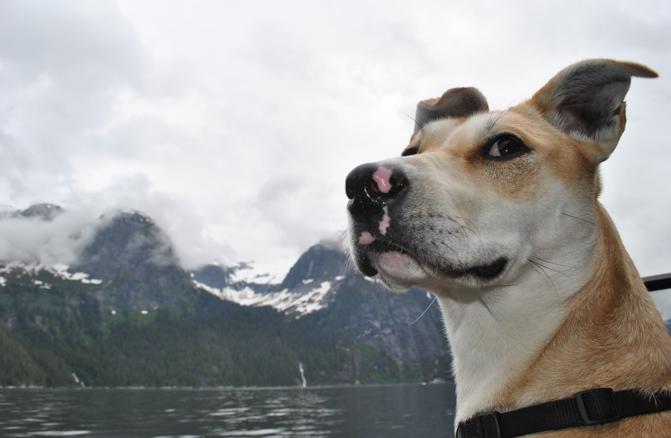
entertaining for Cailey. Much like the clumps of icy snow we
shoveled
from the driveway last winter, Cailey bit and scratched and crunched on
that
berg for quite a while until we finally dumped it overboard! This
may
have enhanced an already avid interest she seemed to have in the water
and ice
bergs around us, and we kept worrying about her leaning too far over
the side
of the boat.
I was grateful that the rain had stopped (which isn't uncommon at the
head of
Tracy Arm) and as we approached the junction, we felt the warmth of the
sun,
very welcome in the glacial chill. As we passed the other boat, I
turned
to wave, resulting in an impact with an ice berg at speed that I wish
I'd
avoided. The boat didn't start taking on water, though, so I
figured we
were safe. We accidentally got quite close to another seal mother
and her
pup, unfortunately alarming the pup enough to go into the water
(followed by
its mother). In all my time at Tracy Arm, I don't think I'd ever
seen
such a concentration of mother-pup pairs. We must have hit the
pupping
season at its height and, in fact, we did see two juvenile eagles
perched on a cliff as we pulled away from the South Sawyer (they
ostensibly come
to feed
on afterbirth and stillborn pups). As we made our way into the
Sawyer
Glacier's arm, we had to pass through a narrow arc of small ice bergs,
which we
did slowly enough not to make them a threat. Beyond that, as is
typical,
the ice bergs were sparse, dispersed by the steady breeze blowing down
from the
Stikine Ice Field. I mumbled a little about the possibly origin
of the moraine
through which the large waterfall (called McBridalveil Falls by my crew
and I
back in the day) cascades, but I think everyone was wearing out by
then.
We passed the reddish point and its little waterfall, which were newly
exposed
during the time I frequented Tracy Arm....and the glacier was still
quite far
away. A whole section of fjord--made half a mile long--had been
uncovered
in the last six or eight years. The Sawyer Glacier always has a
primal
feeling to i t,
and this day was no exception. The rapid rate of
retreat
means that the cliffs to either side of the fjord for some distance are
barren
rock, and the wind coming off the glacier for some reason makes me
think of the
first humans entering North America between sheets of continental
ice. We
stopped
about a quarter mile from the face--a sheer, blue cliff--and shut down,
watching snowball-like ice chunks plummet to the sea with a sound that
gave
away their large size.
t,
and this day was no exception. The rapid rate of
retreat
means that the cliffs to either side of the fjord for some distance are
barren
rock, and the wind coming off the glacier for some reason makes me
think of the
first humans entering North America between sheets of continental
ice. We
stopped
about a quarter mile from the face--a sheer, blue cliff--and shut down,
watching snowball-like ice chunks plummet to the sea with a sound that
gave
away their large size.
By that time we were all definitely chilly and, while the glacier was
impressive, I got the impression that everyone would be pleased to warm
up a
little and get to camp. With some encouragement from Chris, I
decided it
was time for my secret treat. I thought the glacier deserved a
little
more time, so I pulled out my pack and unearthed four "hot
cans"--three cafe lattes and cafe mocha for Rob. I discovered
these
at Western Auto this spring and was immediately taken with the
idea.
They're cans of hot drinks and soups that, after pushing a button and
shaking a
little, produces piping hot liquid. Chris and I had tried them
once
before and found them frustratingly complicated (mostly because the
three or
four sets of instructions on the can were inconsistent, and the
expected
steaming behavior failed to happen), the results a warm, but in no way
hot,
drink. But we thought they were worth another try, and this was
precisely
the sort of situation that warranted them. And, anything warmer
than the
nippy breeze would be welcome! In the end, our experiences were
similar,
and our drinks never really got hot. But they did get quite warm
and were
a pleasure to hold and to drink while we drifted rapidly away from the
glacier,
somehow avoiding every iceberg we passed. Having finished our
drinks, we
started to make our way home, this time along the opposite side of the
fjord
which was more densely clustered with ice. A few times I simply
shut down
with some momentum, and drifted through them. Other times I
maneuvered
around them; it was actually quite fun, picking the way through the ice
is a
lot more interesting than most boat driving is! We passed two
more
mother-pup seal pairs (an uncommon sight in this arm), and I went out
of my way
to avoid one of them.
Soon enough we'd passed the island again and were heading back down the
main
arm. I stopped at my favorite Tracy Arm spot, The Nook, which is
a
square cove with a waterfall coming down the back, big enough to fit
several
Ronquils or the back half of
the big catamarans I use to work
on.
The cliffs around the waterfall are overhung with flowers and it's
gorgeous. We also hit the wildflower season pretty well--scarlet
red
paintbrushes grew in clumps near orange columbine, blue lupine, and a
couple different
kinds of yellow flowers. But by that time
it was
after six, so we streaked our way through a puzzlingly foamy fjord to
the first
U-shaped valley. We brought the Ronquil
up onto seaweed covered
rocks
beyond the outlet of the creek and unloaded everything. While the
others
set about looking for campsites and getting ready for dinner, I
refueled the
boat (we'd run out of our next ten gallons just a few hundred yards
from the
beach and had switched tanks briefly) and anchored it on shore.
I'd hoped
that the creek's current would hold it off shore, but it seemed to want
to hug
the shore around the corner instead. But we knew we were the last
boat in
Tracy Arm, so there was no wake concern until the first one entered in
the
morning.
 By the time I was
finished, potential sites had
been
found in the small
copse
of widely-spaced spruces and Chris was collecting firewood.
Stepping into
the woods, I was very surprised to find not just natural clearings
where we
could camp, but perfectly flat openings beneath the trees that looked
like they
were perfectly manicured campsites. And between them, spires of
dead
alders that begged to be broken down and carried to a campfire.
We opted
to camp in the open on the grassy, flat stretch of beach between the
edge of
the alders/spruces and the intertidal zone. It was covered in
blooming
nagoonberries and short grass (and bear poop). Katie was getting
ready to
cook and needed a campfire, but we hadn't found a single evidence of
fire, and
certainly no fire ring. That was very puzzling! We
knew that
both recreational kayakers and kayak rangers camped in Tracy Arm and
surely had
used this site many times (and there were some cut trees in the woods
and paths
that could have been human rather than bruin, not to mention a beer
can). The other valleys
could be
camped in, but surely wouldn't be as enticing. I knew fires were
legal,
so why had no one lit one? Unfortunately, the intertidal zone on
this
beach was all seaweed-covered rocks, so our fire would have to be on
vegetation. I may have annoyed the others about how careful I
wanted to be....any
fire we built was going to destroy the vegetation beneath it, which I
really
hated to do to a pristine beach (there was really no evidence that
anyone had
camped there yet this year, and I didn't want to ruin it for the next
folks). We wound up carrying rocks up from the beach to form the
base of
a campfire as well as ring around it. I thought that might give
the
vegetation underneath a chance to survive, and planned to remove the
ring the
next day.
By the time I was
finished, potential sites had
been
found in the small
copse
of widely-spaced spruces and Chris was collecting firewood.
Stepping into
the woods, I was very surprised to find not just natural clearings
where we
could camp, but perfectly flat openings beneath the trees that looked
like they
were perfectly manicured campsites. And between them, spires of
dead
alders that begged to be broken down and carried to a campfire.
We opted
to camp in the open on the grassy, flat stretch of beach between the
edge of
the alders/spruces and the intertidal zone. It was covered in
blooming
nagoonberries and short grass (and bear poop). Katie was getting
ready to
cook and needed a campfire, but we hadn't found a single evidence of
fire, and
certainly no fire ring. That was very puzzling! We
knew that
both recreational kayakers and kayak rangers camped in Tracy Arm and
surely had
used this site many times (and there were some cut trees in the woods
and paths
that could have been human rather than bruin, not to mention a beer
can). The other valleys
could be
camped in, but surely wouldn't be as enticing. I knew fires were
legal,
so why had no one lit one? Unfortunately, the intertidal zone on
this
beach was all seaweed-covered rocks, so our fire would have to be on
vegetation. I may have annoyed the others about how careful I
wanted to be....any
fire we built was going to destroy the vegetation beneath it, which I
really
hated to do to a pristine beach (there was really no evidence that
anyone had
camped there yet this year, and I didn't want to ruin it for the next
folks). We wound up carrying rocks up from the beach to form the
base of
a campfire as well as ring around it. I thought that might give
the
vegetation underneath a chance to survive, and planned to remove the
ring the
next day.
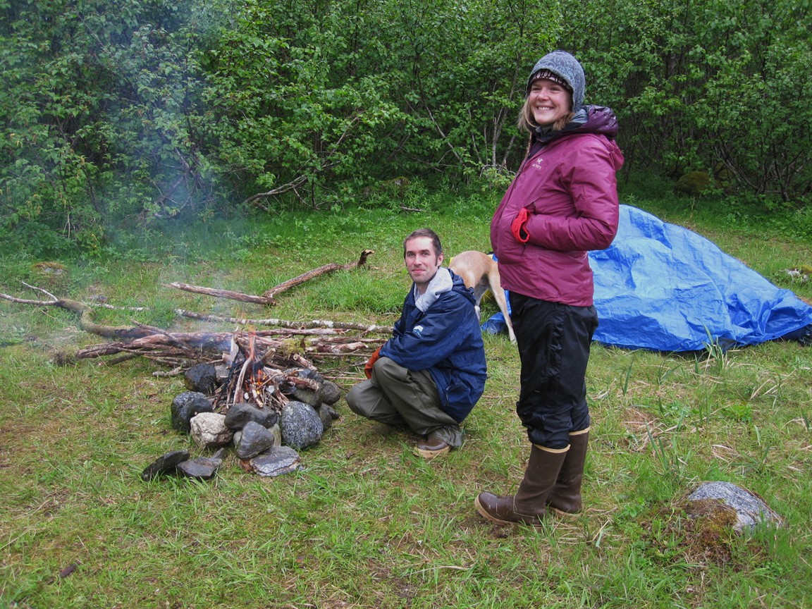
Chris and I continued gathering firewood while Katie prepped
dinner.
By this time, the rain had returned and most of our gear was piled
under the
tarp. Chris and I set up our tent on one side of the park and I
pulled
out the dog rain jacket I'd bought Cailey the day before and tried it
out. I figured it would both keep her from being continually
soaked and
would help warm her up. I am generally anti-dog clothing but....I
wound
up with a dog that lacks an undercoat and it was raining very
hard. Rob
tried his luck fishing, first at the very mouth of the creek and then
from the
beach; he had one nibble and saw an unfamiliar fish follow his
lure in,
but nothing else. He pointed out a black bear on the other side
of the
creek who moseyed around from behind the rocks several times over the
course of
the evening. Katie cooked up an amazing meal of couscous cooked
over our
camping stove and vegetables cooked over the fire. It was
fantastic, and
put to shame the meals (if you can call them that) that I usually make
while
camping! I chopped up one of the pieces of glacier ice Katie had
collected and we drank glacial chilled pomegranate
juice and vodka with
dinner, which Katie and Rob had brought along, as well as wine.
We were
all decked out in full rain gear and boots, as we had been all day,
sitting in
wet camp chairs around the fire while we ate, then standing around the
fire and
drying various items. I dried Cailey's boat blanket (the one that
I leave
on the boat and drape over her when she gets chilly) as well as the new
fleece
pad that she lays on, both for that night and so she could at least
start the
day with a dry bed. At some point during the evening we heard a
crack of
thunder and looked over to see an avalanche coming down the side of the
valley
wall behind us. It went on long enough that I managed to take a
quick
video.
 Leaving the homestead |
 Cheerily leaving the homestead |
 Green rocks alon gthe Snettisham Peninsula |
 Looking down Stephen's Passage on the way |
 Black bear eating barnacles |
 Approaching a spectacular iceberg |
 Iceberg close up |
 Swollen waterfalls |
 Approaching the Big Bend |
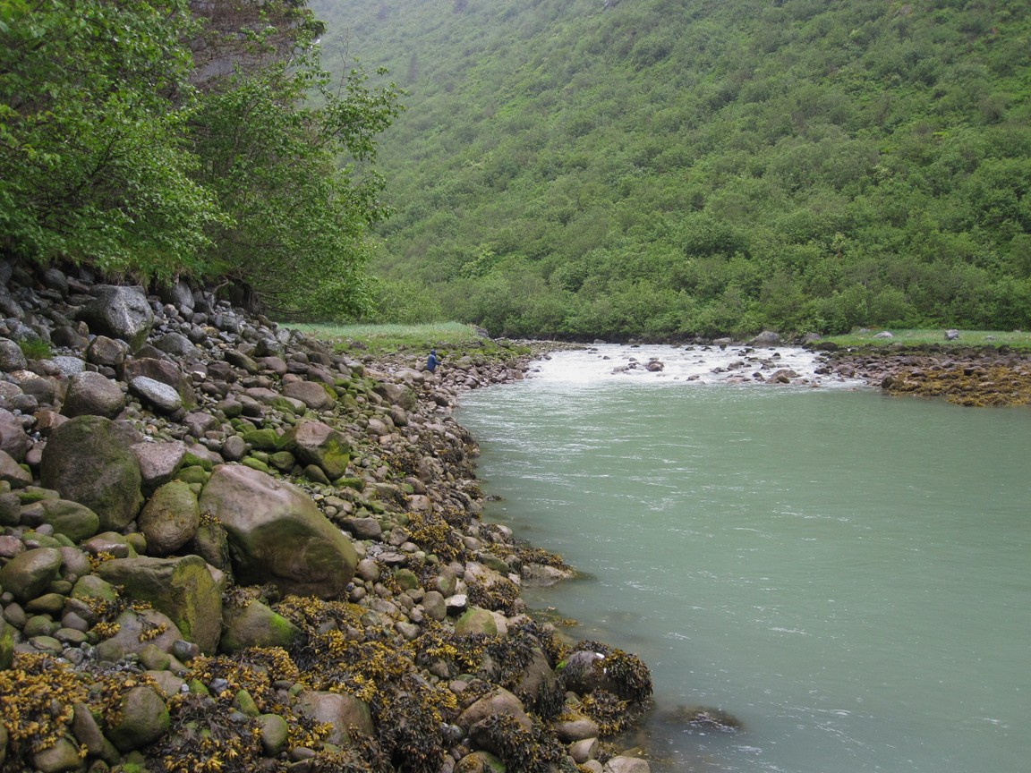
 Intertidal zone |
 Spectacular cliffs |
 More cliffs |
 Tracy Arm |
 Cailey checks out the scenary |
 More cliffs! |
 Holes worn in the cliff |
 View looking up Tracy Arm |
 More scenic cliffs |
 Breaking for lunch in U-Valley 3 |
 The view up U-Valley 3 |
 The creek rushing out of U-Valley 3 |
 The view from up U-Valley 3 (Rob's photo) |
 Harbor seal mother and pup |
 Harbor seals on the ice |
 South Sawyer Glacier |
 Arctic terns (Rob's photo) |
 Chris, Debbie, and Cailey (Rob's photo) |
 Katie, Rob, and Cailey |
 Cailey enjoys an iceberg (Rob's photo) |
 Iceberg at the junction (Rob's photo) |
 Mother and pup (Rob's photo) |
 Left edge of Sawyer Glacier (Rob's photo) |
 Rob checks out the Sawyer Glacier |
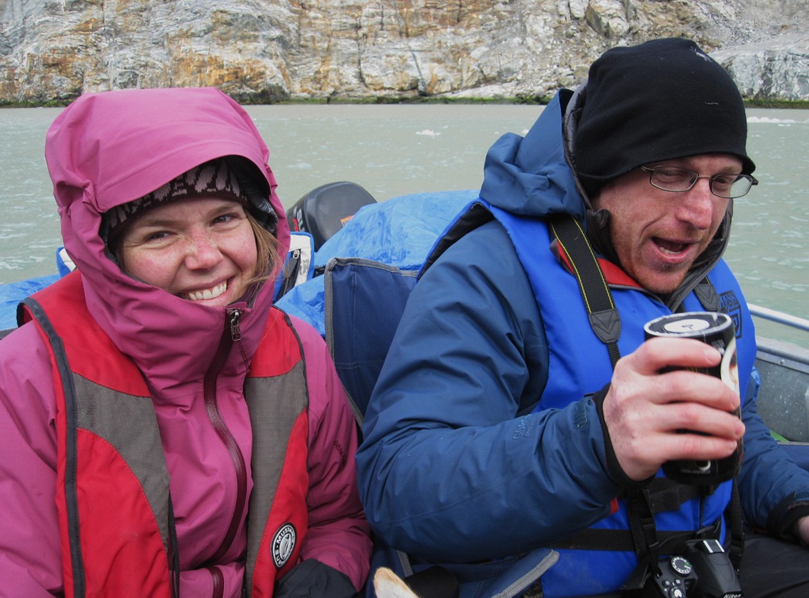 Katie and Rob enjoy hot cans |
 Iron oxidizing on the cliffs (Rob's photo) |
 Woking our way through ice floes on the way out |
 Caiely looks out over the icebergs |
 Flowers in the Nook |
 Cailey helps gather firewood |
 The creek flowing out of our valley |
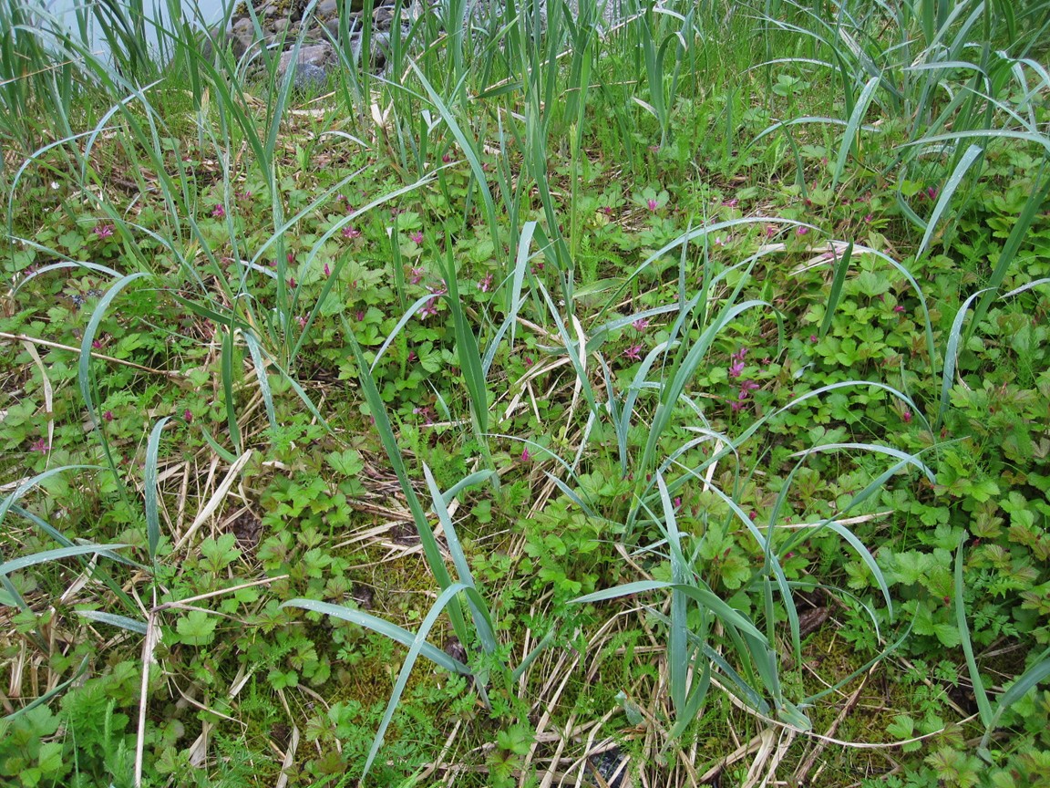 Nagoonberries at our campsite |
 Avalanche! |
 Black bear across the creek |
 Chris and Katie show off dinner |
 Chris tackles Cailey |