June 13-17, 2012
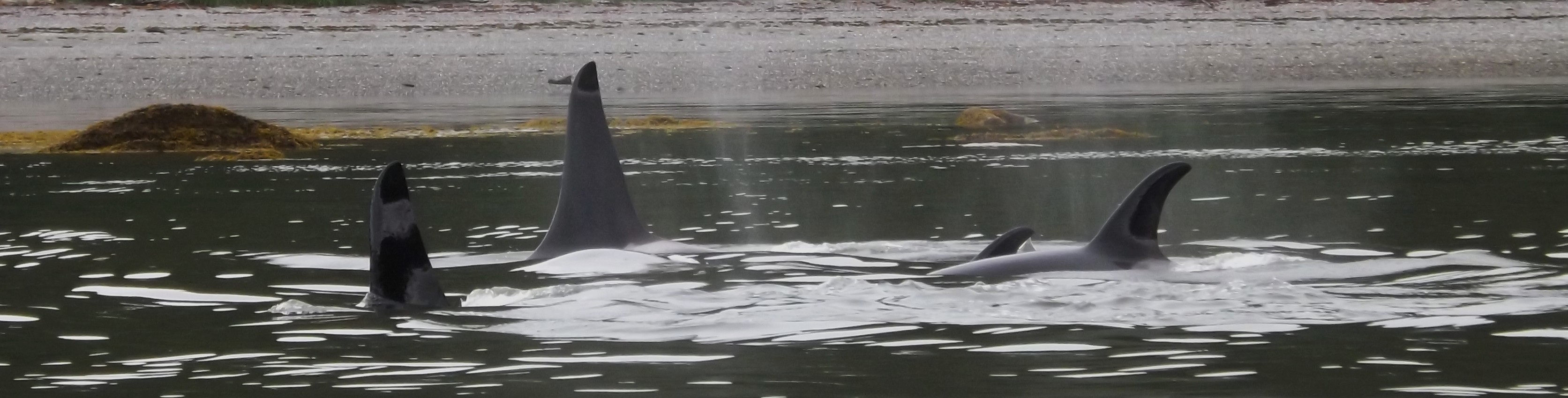
AG pod
Tracy
Arm - Days 4-5
June 13-17, 2012
AG pod
 At
4:00 I got up again and found the boat
perfectly situated off the
bank. At 6:00 I let out a little more anchor line (because the
tide was
turning and I didn't want it pulling anchor if there wasn't enough line
as it
rose above the point at which I'd tossed it out the night before) and
went back
to bed for good. So, not the most restful night! I got up
later
than Katie and Rob, who had the start of a fire and hot water going
when I
emerged. Rob had gathered more dry wood but was still struggling
to get
anything going--my foray into the woods to find tinder to help yielded
very
little that wasn't thoroughly soaked from the night's rain. We
did
eventually get a nice fire going, though, which allowed us all to dry
some of
our rain gear a little before we left. It was foggy, but not
rainy, and
nice to put on a rain jacket that at least wasn't wet on the
inside. The
gravel bar had been a neat camp site, but the wet sand had migrated
everywhere
and stuck to everything! We packed up and left around noon,
impressed by
our consistently improving packing and loading skills.
Thankfully, Chris
remembered to dig up Cailey's bone, which she began devouring
immediately. Endicott Arm was flat calm and I was grateful that
the front
had moved through in the night and left us this peaceful morning.
We
crossed the fjord, passing a whale or two farther down the arm, and
went to
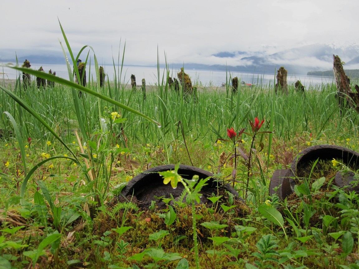
Sanford Cove, the old site of the town of Sumdum. Founded to
support
nearby mines, Sumdum actually housed a post office until 1942!
Chris,
Rob, and Cailey went exploring while Katie and I stayed on board. I
went up the
beautiful brown water creek as far as I could along a grassy meadow
with
pilings and fished as we drifted out. It was very pleasant,
drifting
along the old shoreline, chatting with Katie, and casting (with
absolutely no
success). We started to head toward another creek farther down
the beach,
but turned back when I heard the boys yelling for me (though it turns
out they
were yelling for bears). We later picked up the boys at the beach
and I
poked my head into the woods long enough to see a cluster of metal
artifacts
while Rob panned for gold a little at the shore. The boys had
found other
remains, including a pipe in the creek and old cart wheels, and came
across a
big picturesque waterfall a few bends up the creek. All in all it
seemed
like a perfectly beautiful waterfront for a town and very protected, we
soon
found out, from the southeast. I wondered what it was like in a
northerly
storm.
At
4:00 I got up again and found the boat
perfectly situated off the
bank. At 6:00 I let out a little more anchor line (because the
tide was
turning and I didn't want it pulling anchor if there wasn't enough line
as it
rose above the point at which I'd tossed it out the night before) and
went back
to bed for good. So, not the most restful night! I got up
later
than Katie and Rob, who had the start of a fire and hot water going
when I
emerged. Rob had gathered more dry wood but was still struggling
to get
anything going--my foray into the woods to find tinder to help yielded
very
little that wasn't thoroughly soaked from the night's rain. We
did
eventually get a nice fire going, though, which allowed us all to dry
some of
our rain gear a little before we left. It was foggy, but not
rainy, and
nice to put on a rain jacket that at least wasn't wet on the
inside. The
gravel bar had been a neat camp site, but the wet sand had migrated
everywhere
and stuck to everything! We packed up and left around noon,
impressed by
our consistently improving packing and loading skills.
Thankfully, Chris
remembered to dig up Cailey's bone, which she began devouring
immediately. Endicott Arm was flat calm and I was grateful that
the front
had moved through in the night and left us this peaceful morning.
We
crossed the fjord, passing a whale or two farther down the arm, and
went to
Sanford Cove, the old site of the town of Sumdum. Founded to
support
nearby mines, Sumdum actually housed a post office until 1942!
Chris,
Rob, and Cailey went exploring while Katie and I stayed on board. I
went up the
beautiful brown water creek as far as I could along a grassy meadow
with
pilings and fished as we drifted out. It was very pleasant,
drifting
along the old shoreline, chatting with Katie, and casting (with
absolutely no
success). We started to head toward another creek farther down
the beach,
but turned back when I heard the boys yelling for me (though it turns
out they
were yelling for bears). We later picked up the boys at the beach
and I
poked my head into the woods long enough to see a cluster of metal
artifacts
while Rob panned for gold a little at the shore. The boys had
found other
remains, including a pipe in the creek and old cart wheels, and came
across a
big picturesque waterfall a few bends up the creek. All in all it
seemed
like a perfectly beautiful waterfront for a town and very protected, we
soon
found out, from the southeast. I wondered what it was like in a
northerly
storm.
 And so we left on glassy calm water, rounded the
spit, and headed up
Stephen's
Passage along the outside of Harbor Island. The seas immediately
picked
up and it was a bit swelly as we approached and passed Pt. Coke.
I'd say they were three footers, requiring a
constant cycle
of revving up to climb the back side of the swells, slowing down to
slide into
the trough, then throttling back up to reach the next peak.
Thankfully
they
were behind us and the only time I was nervous was when the starboard
bow would
catch on the upcoming swell and drag us along the side of the boat to
port. But mostly I slowed down and directed the boat to avoid
that.
The swells laid down a little past the Midway Islands, which was good
because
the engine acted like it was out of gas and I had to go back to switch
tanks. Although I made no indication of it to the others, I was a
little
worried about that, as I expected that tank to take us well into
Snettisham,
and probably all the way to the homestead. Instead, we were way
out in
Stephen's Passage and only had one gallon of gas left beyond the five
gallons
in the smaller tank. Could my calculations have been so far
off? The engine had been acting funny the
previous
afternoon, too, as though it was running out of gas, but never
actually
dying. A few seconds would go by and it would pick up
again. I
attributed it to the packs pinching the fuel line, which seemed to make
sense,
and moving the packs seemed to improve the situation. However,
the packs
were not the culprits on this occasion. I discovered at the
homestead that
there was still quite a bit of gas in the main tank (which was a
relief).
The smaller tank took us all the way in, but just barely--it died while
I was
anchoring the boat!
And so we left on glassy calm water, rounded the
spit, and headed up
Stephen's
Passage along the outside of Harbor Island. The seas immediately
picked
up and it was a bit swelly as we approached and passed Pt. Coke.
I'd say they were three footers, requiring a
constant cycle
of revving up to climb the back side of the swells, slowing down to
slide into
the trough, then throttling back up to reach the next peak.
Thankfully
they
were behind us and the only time I was nervous was when the starboard
bow would
catch on the upcoming swell and drag us along the side of the boat to
port. But mostly I slowed down and directed the boat to avoid
that.
The swells laid down a little past the Midway Islands, which was good
because
the engine acted like it was out of gas and I had to go back to switch
tanks. Although I made no indication of it to the others, I was a
little
worried about that, as I expected that tank to take us well into
Snettisham,
and probably all the way to the homestead. Instead, we were way
out in
Stephen's Passage and only had one gallon of gas left beyond the five
gallons
in the smaller tank. Could my calculations have been so far
off? The engine had been acting funny the
previous
afternoon, too, as though it was running out of gas, but never
actually
dying. A few seconds would go by and it would pick up
again. I
attributed it to the packs pinching the fuel line, which seemed to make
sense,
and moving the packs seemed to improve the situation. However,
the packs
were not the culprits on this occasion. I discovered at the
homestead that
there was still quite a bit of gas in the main tank (which was a
relief).
The smaller tank took us all the way in, but just barely--it died while
I was
anchoring the boat!
When we all mustered at the lodge, I confessed that, much as I like
adventuring, it's also nice to come back to a familiar place, and
everyone
seemed to agree with that. We covered the upper deck of the lodge
with
our gear, sandy from the beach and wet from the rain, and circled the
wood stove with
assorted gear that needed drying. We hadn't had lunch yet, so
Katie made
us tuna melts and smoked salmon melts and we ate with gusto. In
the
afternoon we relaxed and each took turns in the "birthing pool" to
freshen up (the pool the boys created last summer in the nearby
creek).
The six weeks of nearly solid rain had the creek roaring and it was
more raging
than serene! Later in the evening, Katie made an amazing pasta
dish. We planned the next day's adventure and went to bed; with
my boat
safely at anchor, I luxuriated in drifting off to bed between sheets.
Our plan was to leave the next day at 10:00, so we all gathered
in the
lodge to
warm up with a fire, drink some Katie coffee drinks, and have
breakfast.
We managed to leave about 10:15, which I call pretty good! The
water was
calm as we cruised across Gilbert Bay and down the port to Doc Fushe's
cove. The center of our plan was to find the Crystal Mine, one of
two
main mines in that area. With information from several sources,
we were
able to put together a pretty good idea of where they were. The
Mines of
the Juneau Goldbelt book that Rob gave me last summer had a few
tantalizing
details, including the presence of not one but two corduroy roads, one
leading
to the Friday Mine from the ruins we explored last summer, and one in
another
place leading to the Crystal Mine. Everything came together with
data Rob
had, which he loaded onto his new GPS; he not only had the actual
coordinates
of the mines, but his map showed two "foot trails" leading to the
mines and, in fact, intersecting. We figured they had to be the
corduroy
roads! The third part of the puzzle was Doc Fushe's cabin, which
sits on
the inside of a cove closer to Stephen's Passage. Although we
hadn't
found it the last time we were there, my dad said there was a road
right behind it
that he thought
led to the Crystal Mine as well. We opted to go to Doc's cabin
because
that way we could be sure of seeing something (the ruins) and hoped to
either
follow the trail or bushwhack it across country in the hopes of hooking
up with
the second corduroy road, which runs perpendicular to shore. The
final owner of the Crystal Mine lived in a cabin somewhere nearby until
his death there; we suspect that Doc Fushe simply adopted that cabin as
his own (and also subsequently died there), which would explain why
there was a trail to the mine.
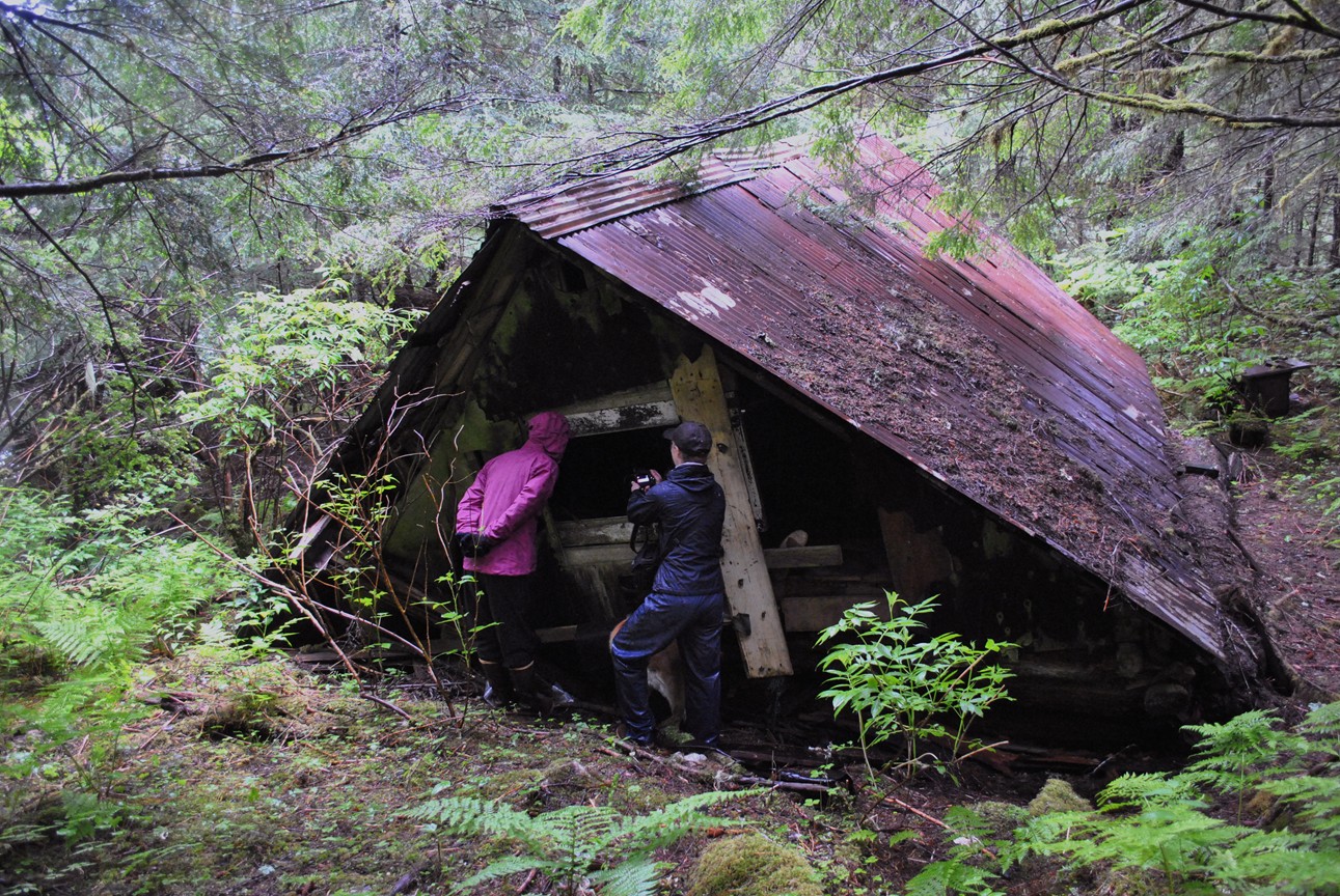 We found Doc's compound in much the same state as
when Chris, Gabe, and
I
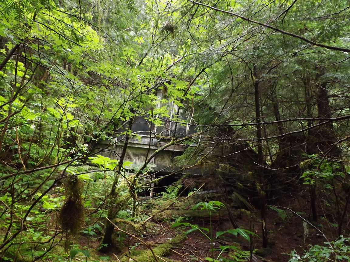
explored it several years ago. There are actually two
buildings--my dad
says the one by the water is the shop, which used to have a covered,
connecting
walkway to the house on the other side of the tiny creek. We saw
old
pipes in that creek as we crossed it. We peered inside the
collapsed
house at the trash left behind, admired its rough hewn logs, and
perused the
refuse surrounding it. Unfortunately, we saw no sign of a trail,
so we
started bushwhacking along the bottom of the steep slope behind it,
keeping a
close eye
on the GPS to track our progress. The going was infinitely better
than it
was in Avalanche Valley--fairly open woods with more skunk cabbage and
blueberry bushes than salmonberries and devil's club. Everything
was
soaking wet, though, from the rain through the night, and we were wet
from head
to toe (thankfully in our raingear). We made our way over gullies
and
fallen logs, through a beautiful sphagnum bog, and to the top of a
ridge.
Unfortunately, we weren't making great time, and I wanted to be back at
the
boat by high tide. Two hours to tramp around sounds like a long
time
until you get out there! It was clear that we weren't going to
make it to
the trail in time make use of it, let alone find the Crystal
Mine. Chris
and I hiked quickly back to the boat and left Rob and Katie to make
their way
more directly to the beach. Half an hour later we picked them up
on the
rocks and made our way two coves past the little peninsula outside
of Doc Fushe's cove. That's where the map showed the start of the
foot
trail, corroborated by the presence of a single piling on the
beach.
Katie stayed on the beach while the rest of us tramped around.
Within a
couple of minutes I found the corduroy road. Like many beaches in
southeast, there was a narrow shelf of flat land at an elevation
just above
the high tide line, backed by a steep cliff leading up to the rest of
the area.
Once I saw the road cut into the steep embankment behind the shelf, I
had no doubt what
I was
looking at. It was flat, had no large trees growing on it and I
could
even see a few of the logs under the moss. Very exciting
stuff! Chris and
Rob
joined me and we followed it up through a dense thicket of alders and
into a
wet meadow where we saw a straight line of young hemlocks that I
figured were
growing from the logs at the edge of the road. From there it
became less
clear, as it was obviously quite overgrown with moss, and the whole
area had the
type of sparse vegetation that could have been the same vegetation
you'd expect
on an old road.
We found Doc's compound in much the same state as
when Chris, Gabe, and
I
explored it several years ago. There are actually two
buildings--my dad
says the one by the water is the shop, which used to have a covered,
connecting
walkway to the house on the other side of the tiny creek. We saw
old
pipes in that creek as we crossed it. We peered inside the
collapsed
house at the trash left behind, admired its rough hewn logs, and
perused the
refuse surrounding it. Unfortunately, we saw no sign of a trail,
so we
started bushwhacking along the bottom of the steep slope behind it,
keeping a
close eye
on the GPS to track our progress. The going was infinitely better
than it
was in Avalanche Valley--fairly open woods with more skunk cabbage and
blueberry bushes than salmonberries and devil's club. Everything
was
soaking wet, though, from the rain through the night, and we were wet
from head
to toe (thankfully in our raingear). We made our way over gullies
and
fallen logs, through a beautiful sphagnum bog, and to the top of a
ridge.
Unfortunately, we weren't making great time, and I wanted to be back at
the
boat by high tide. Two hours to tramp around sounds like a long
time
until you get out there! It was clear that we weren't going to
make it to
the trail in time make use of it, let alone find the Crystal
Mine. Chris
and I hiked quickly back to the boat and left Rob and Katie to make
their way
more directly to the beach. Half an hour later we picked them up
on the
rocks and made our way two coves past the little peninsula outside
of Doc Fushe's cove. That's where the map showed the start of the
foot
trail, corroborated by the presence of a single piling on the
beach.
Katie stayed on the beach while the rest of us tramped around.
Within a
couple of minutes I found the corduroy road. Like many beaches in
southeast, there was a narrow shelf of flat land at an elevation
just above
the high tide line, backed by a steep cliff leading up to the rest of
the area.
Once I saw the road cut into the steep embankment behind the shelf, I
had no doubt what
I was
looking at. It was flat, had no large trees growing on it and I
could
even see a few of the logs under the moss. Very exciting
stuff! Chris and
Rob
joined me and we followed it up through a dense thicket of alders and
into a
wet meadow where we saw a straight line of young hemlocks that I
figured were
growing from the logs at the edge of the road. From there it
became less
clear, as it was obviously quite overgrown with moss, and the whole
area had the
type of sparse vegetation that could have been the same vegetation
you'd expect
on an old road.
And then the meadow ended and it was not clear at all which way
the
road
went. I started crashing into the woods to the right and soon
came across
a piece of survey tape. All three of us took different paths
through that
area and all of us came across many old stumps, no doubt trees cut to
make the
corduroy road. At first I thought that was a good sign until I
realized
how many trees it would take to make such a road--they must have
sourced them
for some distance. We eventually hit a dead end at the edge of a
steep
gully--the road must have been to the left of it. We did come
across a
stand of very large cedar trees, though, which is always neat.
And then
it was high tide, so I left the guys and hurried back down to the water
to make
sure the boat was floating. I joined Katie there, who was
serenely
looking out onto the water and willing herself to warm up, having
become
inexplicably soaked during the initial hike. We could hear the
raucous
sea lions at the winter haul-out across the Port, which was quite
surprising,
as I think they're usually gone by early June at the latest. I
wonder if
they are hanging around longer than usual this year, or could it be
that I just
haven't been paying enough attention? I usually don't go close
enough to
that side of the port unless I'm going to see them specifically or
seeking
shelter during a southeasterly chop behind Mist Island.
When the boys showed up we shoved off and headed home, eating lunch on
our way
out of the port. We had a pleasant enough following sea all the
way up
Stephen's Passage. Unfortunately, we continued experience the
strange
anomaly of the engine starting to slow down, then picking up
again. After
several successive episodes, I finally got up, drained the fuel filter
(which
was half water) and switched tanks. I wish I hadn't switched
tanks so I
had a better idea if it was the fuel filter, but in any event, the
episodes
stopped and we continued unimpeded. We entered the channel around
2:15; I
was a little chilled and thinking that we only had 20 more minutes in
the boat
until we were back to civilization. Then a big, male orca erupted
to the
side of us! I might have squealed quietly in excitement and Katie
summed
it up with her comment, "Now this trip is perfect."
 Behind
us we saw a few fins back out in Taku Inlet, and in front there
was a
group a little closer in, farther up the channel. The bull
slapped the
water with his big, curled flukes twice while we watched him. I
never got
a photo of his saddle patch but I'm fairly confident it was AF19
(a.k.a.
Sergius), the only big male I know of with a very open saddle
patch. So I
figured we were seeing AF22 pod again, the pod (and individual) I saw
twice
last summer. He headed back toward Taku Inlet, though, and the
closer
group was still in the channel, so we stuck with them. For a
while they
didn't seem like they could make up their minds which way to go,
turning
around
a lot but not exactly milling, but we were probably confused by the
fact that
there were, in fact, two large groups there. Suddenly they
switched
gears, grouped up together, and started headed out of the channel with
a
purpose, traveling
along the Douglas shore. The water was glass and the orcas
stunning as
they came up one after another like an oiled machine, blow blow blow
blow blow
blow blow blow blow, each new dorsal fin slicing the surface in
succession. There was one young calf that came up more often than
the
others, and at least three large males. One had a tall dorsal fin
and a
thumb in the saddle patch and looked like AG13; another had a tall
dorsal fin
with a closed saddle patch (possibly AG21); and the other had a
shorter, triangular fin
with a
tiny hint of a thumb. Among them were many many females and
younger
animals and every time they came up for a breathing cycle I was newly
stunned
by how beautiful they were.
Behind
us we saw a few fins back out in Taku Inlet, and in front there
was a
group a little closer in, farther up the channel. The bull
slapped the
water with his big, curled flukes twice while we watched him. I
never got
a photo of his saddle patch but I'm fairly confident it was AF19
(a.k.a.
Sergius), the only big male I know of with a very open saddle
patch. So I
figured we were seeing AF22 pod again, the pod (and individual) I saw
twice
last summer. He headed back toward Taku Inlet, though, and the
closer
group was still in the channel, so we stuck with them. For a
while they
didn't seem like they could make up their minds which way to go,
turning
around
a lot but not exactly milling, but we were probably confused by the
fact that
there were, in fact, two large groups there. Suddenly they
switched
gears, grouped up together, and started headed out of the channel with
a
purpose, traveling
along the Douglas shore. The water was glass and the orcas
stunning as
they came up one after another like an oiled machine, blow blow blow
blow blow
blow blow blow blow, each new dorsal fin slicing the surface in
succession. There was one young calf that came up more often than
the
others, and at least three large males. One had a tall dorsal fin
and a
thumb in the saddle patch and looked like AG13; another had a tall
dorsal fin
with a closed saddle patch (possibly AG21); and the other had a
shorter, triangular fin
with a
tiny hint of a thumb. Among them were many many females and
younger
animals and every time they came up for a breathing cycle I was newly
stunned
by how beautiful they were.
 As
they headed down the channel with us, they were mostly business,
with the occasional
tail slap thrown in. Except for one exception. Out of
nowhere, a
female/young male porpoised out of the water quite close, and somehow
both Rob
and I managed to take decent pictures of it! When they rounded
Marmion
Island, the mood seemed to change. They spread out a bit and
became more
playful. There were more little tail slaps and the mood generally
became
more relaxed. We were shut down while I took a long video during
which
two orcas
broke formation and surfaced quite close; one raised his head above the
water
to take a look at us and the other just raised his tail in the
air. I
caught it on video, and Rob got the photo. When I stopped the
camera I
definitely squealed in delight, for there's nothing better than eye
contact
with a curious orca. Unfortunately, we'd spent some time with
them and needed
to get back, so reluctantly turned and let them go on by themselves,
watching
one spyhop (I like to think he was looking for us) as we turned
away. The
group seemed to have dispersed somewhat, some heading into the center
of Stephen's Passage, others moving along the shore. I could have
followed
them all
night. We never saw the orcas that were back in Taku Inlet when
we caught
up with our group, nor did we see AF19 again. After studying the
photos, I'm fairly confident that we were traveling with AG pod, which
makes me
think that the others in Taku Inlet were AF22 pod. Perhaps they'd
finished a superpod, perhaps
they had
a chance encounter and AF19 was checking out AG pod. I think it's
interesting
that the last three times I've seen AF19 he's been alone (meaning
without an
immediate companion). Males often travel with their mothers, but
AF19's
mother, AF22 (the former matriarch of his pod) has passed away.
It's good
to see that he's still around, as adult male
resident orcas often
do not long outlive their mothers.
As
they headed down the channel with us, they were mostly business,
with the occasional
tail slap thrown in. Except for one exception. Out of
nowhere, a
female/young male porpoised out of the water quite close, and somehow
both Rob
and I managed to take decent pictures of it! When they rounded
Marmion
Island, the mood seemed to change. They spread out a bit and
became more
playful. There were more little tail slaps and the mood generally
became
more relaxed. We were shut down while I took a long video during
which
two orcas
broke formation and surfaced quite close; one raised his head above the
water
to take a look at us and the other just raised his tail in the
air. I
caught it on video, and Rob got the photo. When I stopped the
camera I
definitely squealed in delight, for there's nothing better than eye
contact
with a curious orca. Unfortunately, we'd spent some time with
them and needed
to get back, so reluctantly turned and let them go on by themselves,
watching
one spyhop (I like to think he was looking for us) as we turned
away. The
group seemed to have dispersed somewhat, some heading into the center
of Stephen's Passage, others moving along the shore. I could have
followed
them all
night. We never saw the orcas that were back in Taku Inlet when
we caught
up with our group, nor did we see AF19 again. After studying the
photos, I'm fairly confident that we were traveling with AG pod, which
makes me
think that the others in Taku Inlet were AF22 pod. Perhaps they'd
finished a superpod, perhaps
they had
a chance encounter and AF19 was checking out AG pod. I think it's
interesting
that the last three times I've seen AF19 he's been alone (meaning
without an
immediate companion). Males often travel with their mothers, but
AF19's
mother, AF22 (the former matriarch of his pod) has passed away.
It's good
to see that he's still around, as adult male
resident orcas often
do not long outlive their mothers.
<iframe width="420" height="315"
src="http://www.youtube.com/embed/xV-NNHrkgzM" frameborder="0"
allowfullscreen></iframe>
Stunned with the finale to our trip, I changed back to the larger tank,
making
it all the way to Sandy Beach before it gave me more trouble. We
unloaded
the boat efficiently and headed for hot showers and pizza. Next
year,
Ford's Terror and Endicott Arm!
 Rob consulting his GPS on the way to Sanford Cove |
 Arriving at Sanford Cove (Rob's photo) |
 Chris hiking up the Creek (Rob's photo) |
 Tram wheels on the beach |
 Pilings on the beach at Sanford Cove (Rob's photo) |
 Intertidal area at Sanford Cove (Rob's photo) |
 Chris at Sanford Cove |
 Rob panning for gold at Sanford Cove |
 Katie and Rob as we head out on the last day |
 Looking at artifacts at Doc Fushe's cove |
 The workshop? |
 Cailey makes me nervous as she explores |
 The house |
 Looking inside the bottom floor |
 Inside the collapsed attic |
 Log walls |
 Stumps in the surrounding forest |
 Rob checks the GPS as we bushwhack |
 Katie bushwhacking |
 An unexpected sphagnum bog |
 Trust me, this is the corduroy road! |
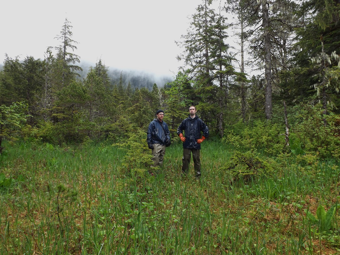 Rob and Chris stand on the corduroy road |
 Katie and Chris resting before we head back |
 Leaving the beach |
 AF19? (Rob's photo) |
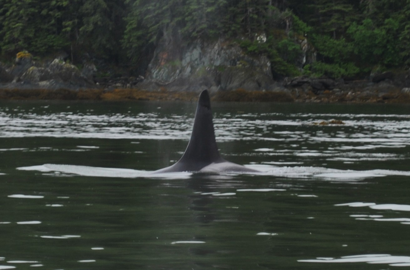 AG13? (Rob's photo) |
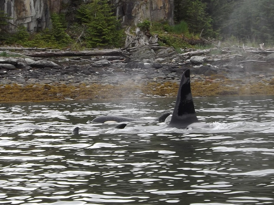 AG21? |
 AG30? |
 AG5 (foreground)? |
 Porpoise! (Rob's photo) |
 Rob's photo |
 |
 |
 Rob's photo |
 Rob's photo |
 Everyone is exhausted when we get home! |